 Crosthwaite 1783-94, tetrad SD39Q

|

|
|
|
gazetteer links places may or may not be labelled on the map |
||

|
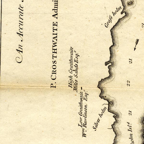
-- Graythwaite Hall -- "High Graithwaite / Miles Sands
Esqr." |
|
|
|
-- Graythwaite Old Hall -- "Low Graithwaite / Wm. Rawlinson
Esqr." |
|
|
|
-- Silver Holme -- "Silver holm" |
|
|
civil parishes The area roughly includes parts of parishes:- Satterthwaite Windermere Colton |
||
|
|
||
|
|
Lakes Guides menu. | |