 Crosthwaite 1783-94, tetrad SD38U

|

|
|
|
gazetteer links places may or may not be labelled on the map |
||

|
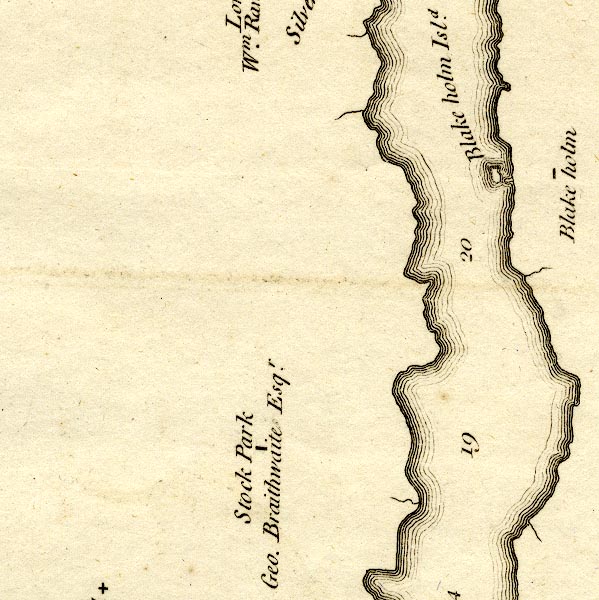
-- Blake Holme -- "Blake holm" |
|
|
|
-- Blake Holme -- "Blake holm Isld." |
|
|
|
-- Stock Park -- "Stock Park / Geo. Braithwaite
Esqr." |
|
|
civil parishes The area roughly includes parts of parishes:- Colton Windermere Claife |
||
|
|
||
|
|
Lakes Guides menu. | |