 Crosthwaite's Maps, 1783-94
 | |
|
Introduction
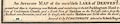
Series of maps, An Accurate Map of the Matchless Lake of Derwent, of the Grand Lake of Windermere, of the Beautiful Lake of Ullswater, of Broadwater or Bassenthwaite Lake, of Coniston Lake, of Buttermere, Crummock and Loweswater Lakes, and Pocklington's Island, by Peter Crosthwaite, Keswick, Cumberland now Cumbria, 1783 to 1794. Derwentwater, scale 3 inches to 1 mile, engraved by S Neele, published 1783; corrected and published 1788, 1794, 1809, 1819; reprinted 1863. Pocklington' Island, engraved by H Ashby, published 1783; corrected and published 1788, 1794, 1809. Windermere, scale 2 inches to 1 mile, engraved by H Ashby, published 1783; corrected and published 1788, 1794, 1809, 1819; reprinted 1863. Ullswater, scale 3 inches to 1 mile, engraved by H Ashby, published 1783; corrected and published 1788, 1794, 1809, 1819; reprinted 1863. Bassenthwaite Lake, scale 3 inches to 1 mile, engraved by S Neele, published 1785; corrected and published 1788, 1794, 1809, 1819; reprinted 1863. Coniston, scale 3 inches to 1 mile, engraved by J Ellis, published 1788; corrected and published 1794, 1809, 1819; reprinted 1863. Buttermere, Crummock Water and Loweswater, scale 3 inches to 1 mile, engraved by S Neele, published 1794; corrected and published 1809, 1819; reprinted 1863. |
|
|
|
|
|
 |
Derwent Water |
|
|
Pocklington's Island |
|
|
Windermere |
|
|
Ullswater |
|
|
Bassenthaite Lake |
|
|
Coniston Water |
|
|
Buttermere, Crummock Water and Loweswater |
|
|
Lakes Guides menu. |