 Clarke 1787 map, tetrad NY31X

|

|
|
|
gazetteer links Places may or may not be labelled on the map. |
||

|
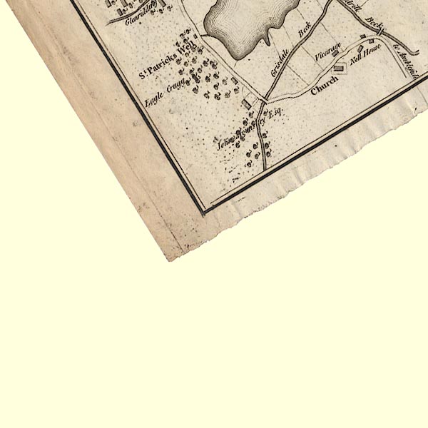
-- "Eagle Cragg" -- Eagle Crag |
|
|
|
-- Grisedale Bridge |
|
|
|
-- Patterdale Hall |
|
|
civil parishes The area roughly includes parts of parishes:- Patterdale |
||
|
|
||
|
|
Lakes Guides menu. | |