 Clarke's Maps 1787
 | |
|
Introduction
Series of maps published in a guide book, Survey of the Lakes of Cumberland, Westmorland and Lancashire, by James Clarke, printed for the author, London, 1787-89; and in Plans of the Lakes ... 1793. There are 11 maps:- plate 1. A Map of the Town of Penrith and Country Adjacent. plate 2. A Map of the Town of Penrith in the County of Cumberland. plate 3. A Map of the Roads between Penrith and Ullswater, scale about 10 ins to 1 mile; shows the River Eamont from Pooley Bridge for about 4 miles NE towards Penrith, and the country and roads either side. plate 4. A Map of the Lake Ullswater and its Environs, scale about 6.5 ins to 1 mile. plate 5. A Map of the Roads, Waters &c between Penrith and Keswick, scale about 2 ins to 1 mile; shows the road from about Stainton to beyond Threlkeld. plate 6. A Map of Derwentwater and its Environs. plate 7. A Map of the Roads etc. between Keswick and Broadwater. plate 8. A Map of Broadwater and its Environs, ie Bassenthwaite Lake, scale about 6.5 ins to 1 mile. plate 9. A Map of the Roads Lakes &c between Keswick and Ambleside, scale about 2.5 ins to 1 mile; shows the road from about Castlerigg to the edge of Ambleside, past Thirlmere Lake, Grasmere water, and Rydal Water. plate 10. A Map of the Northern Part of the Lake Winandermere and its Environs, scale about 6.5 ins to 1 mile. plate 11. A Map of the Southern Part of the Lake Winandermere and its Environs, scale about 6.5 ins to 1 mile. 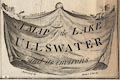  |
|

|
Penrith area |
|
|
Penrith |
|
|
Penrith to Ullswater |
|
|
Ullswater |
|
|
Penrith to Keswick |
|
|
Derwent Water |
|
|
Keswick to Bassenthwaite Lake |
|
|
Bassenthwaite Lake |
|
|
Keswick to Ambleside Thirlmere, Grasmere, Rydal Water |
|
|
Windermere, north |
|
|
Windermere, south |
|
|
Lakes Guides menu. |