 Green 1790s-1829s
|
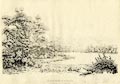
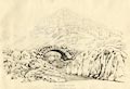
Print, soft ground etching, Coniston Water, Coniston, Lancashire, by William
Green, Ambleside, Westmorland, 1810.
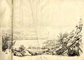
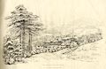
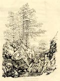
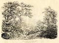
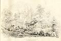
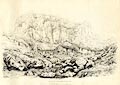
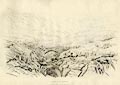
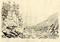
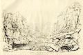
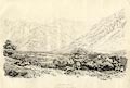
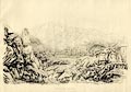
Plate 1 in Sixty Studies from Nature, 1810. No. 1. CONISTON WATER. CONISTON water is six miles in length, and the greatest breadth three quarters of a mile; it is encircled by an excellent road, which is often on the margin of the water and scarcely ever a mile from it: the most interesting part of this road is that which lies on the eastern side of the lake, and is a part of that usually travelled by tourists in their way to Coniston, or Hawkshead, from Ulverstone. ... The view here presented is a mile from the foot of the lake, and is of the Man mountain, or, as it is more frequently called, the Old Man, with the pointed summit of Enfoot on the right, and Dove Crag on the left, a range of line probably more picturesque than is exhibited by these mountains on any stand from or near the road before spoken of; the middle grounds and foregrounds are, however, better on some stations north of the one here chosen. size: wxh, image = 63x42cm (about) source type = Green 1810 (plate 1) (Armitt Library : A6641.1) |
|
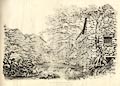
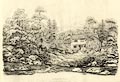
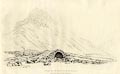
Print, soft ground etching, Buildings at Coniston Water Head, Coniston,
Lancashire, by William Green, Ambleside, Westmorland, 1810.
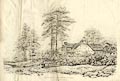
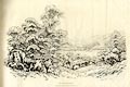
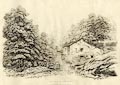
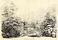
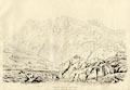
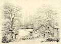
Plate 2 in Sixty Studies from Nature, 1810. No. 2. BUILDINGS AT CONISTON WATERHEAD. The New Inn at Waterhead stands near the head of the lake, and this scene is upon the road from the church and village of Coniston, by that inn to Ambleside; it is about two or three hundred yards from the inn, and that distance from the mansion house, called Waterhead, the property of --- Knott, Esq. and which is still nearer Ambleside. An artist will make various useful selections from these buildings, under different points of view, and he may gain advantage from studies of the local colouring. size: wxh, image = 65x44cm (about) source type = Green 1810 (plate 2) (Armitt Library : A6641.2) |
|
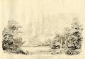
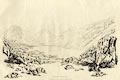
Print, soft ground etching, Yewdale near Coniston, Lancashire, by William
Green, Ambleside, Westmorland, 1810.
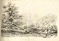
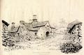
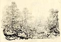
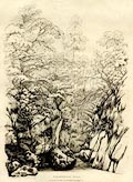
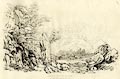
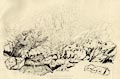
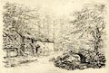
Plate 3 in Sixty Studies from Nature, 1810. No. 3. YEWDALE, NEAR CONISTON. The valley of Yewdale, lies about a mile north-west of Coniston Waterhead. Near the house, part of which is seen in this view, is the famous yew tree, tall and beautifully picturesque, but not umbrageous like these of Patterdale and Lorton; the hill on the right is Raven Crag, that in the distance Enfoot. ... size: wxh, image = 66x43cm (about) source type = Green 1810 (plate 3) (Armitt Library : A6641.3) |
|
Print, soft ground etching, Rothay Bridge near Ambleside, Westmorland, by
William Green, Ambleside, Westmorland, 1808.
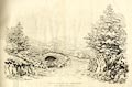
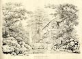
Plate 4 in Sixty Studies from Nature, 1810. No. 4. ROTHAY BRIDGE, NEAR AMBLESIDE. This bridge which spans the Rothay, is half a mile from Ambleside, on the road to Hawkshead, and Whitehaven, over the mountains Hardknot and Wrynose: - and this view is made on the road from Kendal to Whitehaven, over the above mountains, and joins that from Ambleside at the foot of the bridge. The Rydal fells, (the mountains here are generally called fells) beginning with Nab Scar, and ending with Fairfield, close the scene. size: wxh, image = 66x42cm (about) source type = Green 1810 (plate 4) (Armitt Library : A6641.4) |
|
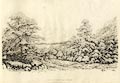
Print, soft ground etching, Ambleside from the Gale, Westmorland, by William
Green, Ambleside, Westmorland, 1808.
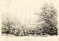
Plate 5 in Sixty Studies from Nature, 1810. No. 5. AMBLESIDE FROM THE GALE. ... The Gale is a field above that in which the fir trees stand as we enter on the Kendal road, the more embodied part of the village, and the most pleasant way of approaching this field on leaving the inns, is on the public road, by the fir trees and Gale house, entering the Gale field at the back of that house. The scene in nature, from the Gale, comprehends more than half a circle, and the part which is here chosen, is looking towards the park and mountains of Rydal; the buildings nearest the eye are a part of the market-place; that over the end of the foot path is the Salutation inn - part of the exhibition-house appears between the fir trees - the ancient building in the centre of this view, belongs to Mr. Edward Partridge, who resides in that part of it which is nearest the Salutation; and beyond this building appears Green Bank, the property of Matthew Harrison, Esq. and residence of the Misses Knott. Rydal hall and Rydal mount may be discovered beyond the fir trees. size: wxh, image = 66x41cm (about) source type = Green 1810 (plate 5) (Armitt Library : A6641.5) |
|
Print, soft ground etching, Windermere lake, Windermere, Westmorland, by
William Green, Ambleside, Westmorland, 1808.
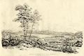
Plate 6 in Sixty Studies from Nature, 1810. No. 6. WINDERMERE. ... This print of Windermere is from a field near the turnpike gate at Waterhead, and is looking into Langdale - Bow fell and Langdale pikes are the principal features in the distance, but a part of Loughrigg fell is on the right - the houses at Brathay and Clappersgate assist in composing the middle ground. - The trees on the left were taken from the hedge-row on the right hand, with a view to benefit the composition - for though the distances on Windermere are exquisite, as seen in nature; yet, by their remoteness from the eye, and the consequent monotony of the lines composing those distances, they generally require the aid of other objects with a view to destroy that monotony, and otherwise improve the intended picture. size: wxh, image = 66x41cm (about) source type = Green 1810 (plate 6) (Armitt Library : A6641.6) |
|
Print, soft ground etching, Cottage in Ambleside, Westmorland, by William
Green, Ambleside, Westmorland, 1808.
Plate 7 in Sixty Studies from Nature, 1810. No. 7. COTTAGE AT AMBLESIDE. This place, which is called Kelsick Buildings, is occupied by several people, and is near the junction in Ambleside of the Kendal and Hawkshead roads. size: wxh, image = 63x42cm (about) source type = Green 1810 (plate 7) (Armitt Library : A6641.7) |
|
Print, soft ground etching, Bark Mill, Ambleside, Westmorland, by William
Green, Ambleside, Westmorland, 1810.
Plate 8 in Sixty Studies from Nature, 1810. No. 8. BARK MILL, AMBLESIDE. The Mills in Ambleside are four, namely, a corn mill, a bark mill, a woollen factory, and a turnery of wood and ivory; they are all upon Stock Gill. ... The bark mill is the property of Messrs. Sewart, Tanners, in Ambleside. size: wxh, image = 63x45cm (about) source type = Green 1810 (plate 8) (Armitt Library : A6641.8) |
|
Print, soft ground etching, Mills at Ambleside, Westmorland, by William
Green, Ambleside, Westmorland, 1808.
Plate 9 in Sixty Studies from Nature, 1810. No. 9. MILLS IN AMBLESIDE. The Bark Mill in the last print, composes likewise a part of the present, and the water which turns the wheel is conveyed in a spout from the corn mill, which is seen upon the opposite side of the river. - The corn mill adjoins the bridge, which is the only one in the town; the distant mountain is Wansfell with its pike. size: wxh, image = 65x44cm (about) source type = Green 1810 (plate 9) (Armitt Library : A6641.9) |
|
Print, soft ground etching, Stock Gill near the Salutation Inn, Ambleside,
Westmorland, by William Green, Ambleside, Westmorland, 1808.
Plate 10 in Sixty Studies from Nature, 1810. No. 10. STOCK GILL NEAR THE SALUTATION INN. This view is about 150 yards above the bridge; Stock Gill in this place is passable when the water is small in quantity, because the rocks point high out of the bed of the river: from the track discoverable between the eye and the house, there is a fine retrospective view to Wansfell; and the Salutation inn, with a peep at Windermere, are not uninteresting objects as we approach the chapel, which is the last building in the village, on the road to Penrith over Kirkstone. size: wxh, image = 63x44cm (about) source type = Green 1810 (plate 10) (Armitt Library : A6641.10) |
|
Print, soft ground etching, Stock Gill, Ambleside, Westmorland, by William
Green, Ambleside, Westmorland, 1808.
Plate 11 in Sixty Studies from Nature, 1810. No. 11. STOCK GILL. About half the way to Stock Gill Force, from Ambleside, is on the horse road to the groves, and the remainder of that way, after having crossed a field about one hundred yards over, is by the side of the brook; and the Stock Gill scene, here presented, is taken near that part of the path which joins the brook. size: wxh, image = 63x46cm (about) source type = Green 1810 (plate 11) (Armitt Library : A6641.11) |
|
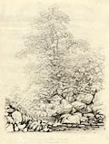
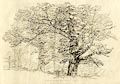
Print, soft ground etching, Cherry Tree, Stock Gill, Ambleside, Westmorland,
by William Green, Ambleside, Westmorland, 1808.
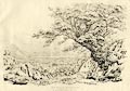
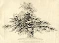
Plate 12 in Sixty Studies from Nature, 1810. No. 12. CHERRY TREE, STOCK GILL. By some unaccountable mistake, the large tree in this print is called a cherry tree, but is in reality a species of wych elm. - The wych elm and the wild cherry tree grow luxuriantly and to a prodigious size on the banks of this little river. size: wxh, image = 45x57cm (about) source type = Green 1810 (plate 12) (Armitt Library : A6641.12) |
|
Print, soft ground etching, Stock Gill, Ambleside, Westmorland, by William
Green, Ambleside, Westmorland, 1808.
Plate 13 in Sixty Studies from Nature, 1810. No. 13. STOCK GILL, AMBLESIDE. This view is about one hundred yards below the water-fall, and like the foregoing three, is down the stream. size: wxh, image = 65x45cm (about) source type = Green 1810 (plate 13) (Armitt Library : A6641.13) |
|
Print, soft ground etching, Study in Stock Gill, Ambleside, Westmorland, by
William Green, Ambleside, Westmorland, 1808.
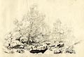
Plate 14 in Sixty Studies from Nature, 1810. No. 14. STUDY IN STOCK GILL. This study of rocks and trees was made thirty of forty yards below the foot of the force. The ramification of such trees as hang on the steep banks of rivers are usually wildly undulating, but straightness is the peculiar character of such as grow near the margins or out of the beds of rivers. size: wxh, image = 45x60cm (about) source type = Green 1810 (plate 14) (Armitt Library : A6641.14) |
|
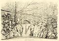
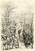
Print, soft ground etching, Stock Gill Force, Ambleside, Westmorland, by
William Green, Ambleside, Westmorland, 1810.
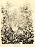
Plate 15 in Sixty Studies from Nature, 1810. No. 15. STOCK GILL FORCE. The beauties of this admired water-fall are in a great degree lost to the generality of visitors, because they only see it from the foot-path, skirting the top of a bank which rises to a great height, and almost perpendicularly from the bottom of the channel; and the spectator looks down upon the scene, rather than upwards or horizontally; his view of the water is likewise considerably impeded by wood, of which there is a redundancy. ... The scene which has been engraved for this work, is made on the margin of the stream, immediately under the usual stand; but from several other points the materials will be found to combine with an equal, if not superior interest, should parts be preferred to a general view. size: wxh, image = 46x60cm (about) source type = Green 1810 (plate 15) (Armitt Library : A6641.15) |
|
Print, soft ground etching, Pelter Bridge, Rydal, Westmorland, by William
Green, Ambleside, Westmorland, 1808.
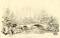
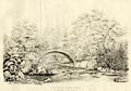
Plate 16 in Sixty Studies from Nature, 1810. No. 16. PELTER BRIDGE, RYDAL. This bridge is a mile from Ambleside, the fore-ground on the left is brought from the other side of the bridge, the drawing being made out of a flat field on the Loughrigg side of the river Rothay - the houses are the beginning of the little village of Rydal, on the road from Ambleside to Keswick. The mountain over the lesser arch of the bridge is Nab Scar, from a certain point of which there is, to a great extent of distance, an exquisite and almost circular view of the country, which is composed of mountains, lakes, rivers, woods, and buildings; and this view, in its kind, is perhaps more interesting than can be furnished by the domains of Rydal from any other summit. size: wxh, image = 67x42cm (about) source type = Green 1810 (plate 16) (Armitt Library : A6641.16) |
|
Print, soft ground etching, Cottage at Rydal, Westmorland, by William Green,
Ambleside, Westmorland, 1810.
This might be Manor Cottage? Plate 17 in Sixty Studies from Nature, 1810. No. 17. COTTAGE AT RYDAL. Part of the building here presented is given in the preceeding print, and this view is higher on the river than the bridge, from which it is not one hundred yards; the townships of Rydal and Ambleside divide on the top of the mountain, the pointed summits of which are the high and low pikes. ... size: wxh, image = 65x42cm (about) source type = Green 1810 (plate 17) (Armitt Library : A6641.17) |
|
Print, soft ground etching, Lower Fall at Rydal, Westmorland, by William
Green, Ambleside, Westmorland, 1810.
Plate 18 in Sixty Studies from Nature, 1810. source type = Green 1810 (plate 18) (Abbot Hall : AH2766.86) |
|
|
Print, soft ground etching, Lower Fall at Rydal, Westmorland, by William
Green, Ambleside, Westmorland, 1810.
Plate 18 in Sixty Studies from Nature, 1810. No. 18. LOWER FALL AT RYDAL. Highly to the credit of the Rydal family, who have given to the public a sight of the falls, excellent foot-paths have been made to them from the road: this view is from a summer-house which is near the hall, and is a scene as complete in its kind as any in the country. - What Mr. Gilpin has excellently said of this fall, will be more properly applied to it as observed from a bank a few yards above the summer-house than from it. - "The water falls within a few yards of the eye, which being rather above its level, has a long perspective view of the stream, as it hurries from the higher grounds, tumbling in various little breaks through its rocky channel, darkened with thicket, till it arrives at the edge of the precipice before the window, from whence it rushes into the bason, which is formed by nature in the native rock." size: wxh, image = 65x45cm (about) source type = Green 1810 (plate 18) (Armitt Library : A6641.18) |
|
Print, soft ground etching, Rydal Beck above the Lower Waterfall, Rydal,
Westmorland, by William Green, Ambleside, Westmorland, 1810.
Plate 19 in Sixty Studies from Nature, 1810. No. 19. SCENE NEAR RYDAL HALL. This view is on the river between the lower fall and the wooden bridge, passed on the way to the upper fall; and perhaps such a scene as Shakespear had in his "mind's eye," when he composed Jacques description of the bankrupt deer, in "As you like it." size: wxh, image = 63x43cm (about) source type = Green 1810 (plate 19) (Armitt Library : A6641.19) |
|
Print, soft ground etching, Windermere from Rydal Park, Westmorland, by
William Green, Ambleside, Westmorland, 1810.
Plate 20 in Sixty Studies from Nature, 1810. No. 20. WINDERMERE, FROM RYDAL PARK. We look towards the foot of Windermere from Rydal park, which, though a flat scene, is beautiful; but distances like the present are not calculated to please in outline. This view is given rather as an exhibition of the oak trees, than of the lake; but the combination has, however, in nature, a fine effect. size: wxh, image = 66x44cm (about) source type = Green 1810 (plate 20) (Armitt Library : A6641.20) |
|
Print, soft ground etching, Rydal Water from Rydal Park, Westmorland, by
William Green, Ambleside, Westmorland, 1810.
Plate 21 in Sixty Studies from Nature, 1810. No. 21. RYDAL WATER, FROM RYDAL PARK. This view is taken near the south-west corner of the park: Beyond the lake appears the road to Keswick, at about two miles and a half from Ambleside; before the road reaches the third mile, there is a fine view of the lake and vale of Grasmere; Langdale pikes and Bow Fell are the remote objects in the scene, which scene, in nature, under some circumstances of effect, is of extraordinary beauty. size: wxh, image = 60x42cm (about) source type = Green 1810 (plate 21) (Armitt Library : A6641.21) |
|
Print, soft ground etching, Oak in Rydal Park, Westmorland, by William Green,
Ambleside, Westmorland, 1808.
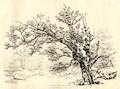
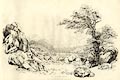
Plate 22 in Sixty Studies from Nature, 1810. No. 22. OAK, IN RYDAL PARK. This picturesque stump is amongst the highest oaks in the park, and till lately, in the neighbourhood of several others, which were good subjects for the pencil. size: wxh, image = 61x45cm (about) source type = Green 1810 (plate 22) (Armitt Library : A6641.22) |
|
Print, soft ground etching, Scene in Rydal Park, Westmorland, by William
Green, Ambleside, Westmorland, 1810.
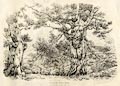
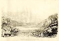
Plate 23 in Sixty Studies from Nature, 1810. No. 23. SCENE IN RYDAL PARK. These oaks are near that last spoken of, and are given as an example of bold foreshortening; the distance between the trees is Nab Scar, north of which the line of mountains stretches nearly to Fairfield. size: wxh, image = 63x43cm (about) source type = Green 1810 (plate 23) (Armitt Library : A6641.23) |
|
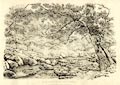
Print, soft ground etching, Rocks on Loughrigg Side, Loughrigg, Westmorland,
by William Green, Ambleside, Westmorland, 1808.
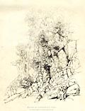
Plate 24 in Sixty Studies from Nature, 1810. No. 24. ROCKS ON LOUGHRIGG SIDE. Part of Loughrigg Fell skirts the western side of Rydal Water, and from its surface are many rocky projections; the study presented is about half way up the hill, from the side of the lake. size: wxh, image = 44x56cm (about) source type = Green 1810 (plate 24) (Armitt Library : A6641.24) |
|
Print, soft ground etching, Goody Bridge in Grasmere, the house, Westmorland,
by William Green, Ambleside, Westmorland, 1808.
A note with a similar print by William Green admits that he has moved the stepping stones nearer the house. Plate 25 in Sixty Studies from Nature, 1810. No. 25. GOODY BRIDGE, IN GRASMERE. The buildings in this scene are called by the name of a stone bridge which is lower down the river, and on the way to Easedale from Grasmere church: to improve the composition, the stepping stones have been brought nearer to the houses than they actually are: the distance is Helme Crag, but the rocks on its summit, called the Lion and the Lamb, cannot be seen from this place. ... size: wxh, image = 67x42cm (about) source type = Green 1810 (plate 25) (Armitt Library : A6641.25) |
|
Print, soft ground etching, Bramerigg Gill, Westmorland, by William Green,
Ambleside, Westmorland, 1808.
This is possibly Greenhead Gill. Plate 26 in Sixty Studies from Nature, 1810. No. 26. BRAMERIGG GILL. About four miles and three quarters from Ambleside, on the Keswick road, stands a smithy, and near to it a bridge, which is over Bramerigg Gill, and this wild dingle is a few hundred yards above the bridge; the stream has its source between Fairfield and Seat Sandal, from which it rapidly descends into Grasmere. size: wxh, image = 44x61cm (about) source type = Green 1810 (plate 26) (Armitt Library : A6641.26) |
|
Print, soft ground etching, St John's Vale, St John's Castlerigg and
Wythburn, Cumberland, by William Green, Ambleside, Westmorland, 1808.
Plate 27 in Sixty Studies from Nature, 1810. No. 27. ST. JOHN'S VALE. This much admired valley opens itself on the eye of the spectator about ten miles from Ambleside, on his approach to Keswick; and this view of it, is from a field on the right of the mile stone, and chosen because the mountains compose better than from the crags on the opposite side of the road; but the traveller ought to have his view from amongst these crags, as the picture is thereby excellently benefited by them as a fore-ground; the stony part of which was added to the distance here presented. The rock of St. John, which rises above Legberthwaite mill, and beyond that rock Wanthwaite Crags, bound the valley on the right, and the How and Naddle Fell on the opposite side; in a fine line see Saddleback end the perspective. ... size: wxh, image = 67x44cm (about) source type = Green 1810 (plate 27) (Armitt Library : A6641.27) |
|
Print, soft ground etching, Helvellyn, from the Foot of Leathes Water, ie
Thirlmere, St John's Castlerigg and Wythburn, Cumberland, by William Green,
Ambleside, Westmorland, 1809.
Plate 28 in Sixty Studies from Nature, 1810. No. 28. HELVELLYN, FROM THE FOOT OF LEATH'S WATER. Wyburn Water, Thril Mere, or Leath's Water, has its latter name from the family of Leath, who have long resided at Dalehead, a venerable edifice on the banks of the lake. This view is from a part of the road immediately west of the foot of the lake, and Helvellyn, as seen from it, is of a more interesting figure than is displayed by it from other situations; its neighbouring summits being high, leave generally but little of the mountain to the view of the spectator, particularly from Coniston Water, Windermere, and Ulls Water. The woods on the opposite banks of the lake are the property of John Stanger Leath, Esq. and his house is seen amongst them. - Between these woods and the high mountains, winds the road from Keswick to Ambleside; and the mile-stone six and ten is not far distant from the house, and immediately beyond it from the eye. size: wxh, image = 64x43cm (about) source type = Green 1810 (plate 28) (Armitt Library : A6641.28) |
|
Print, soft ground etching, Mill in Legberthwaite, St John's Castlerigg and
Wythburn, Cumberland, by William Green, Ambleside, Westmorland, 1809.
The crag behind is Castle Rock. Plate 29 in Sixty Studies from Nature, 1810. No. 29. MILL IN LEGBERTHWAITE. Legberthwaite and St. John are the same valley. Legberthwaite mill is twelve miles from Ambleside, on the road from that place to Threlkeld, which lies under Saddleback; the Threlkeld and Keswick roads dividing about the eleventh mile stone; the grand surface of rock above the mill, is called the rock of St. John. size: wxh, image = 63x42cm (about) source type = Green 1810 (plate 29) (Armitt Library : A6641.29) |
|
Print, soft ground etching, Derwent Water from Castlerigg, St John's
Castlerigg and Wythburn, Cumberland, by William Green, Ambleside, Westmorland,
1809.
Walla Crag on the left. Plate 30 in Sixty Studies from Nature, 1810. No. 30. DERWENT WATER, FROM CASTLERIGG. ... Castlerigg is a mile from Keswick, and about two hundred yards west of the first mile stone on the Ambleside road, and this view is from a field north of the houses, and looking towards the mountains of Borrowdale and Wastdale, of which Great Gable and Great-End are the most remote from the eye; the woods about the village of Grange are seen at the head of the lake, and over them Gate Crag, which is succeeded by a mountain that stretches itself north towards Cat Bells; Wallow Crag, richly dressed in wood, screens the valley on the east. size: wxh, image = 64x42cm (about) source type = Green 1810 (plate 30) (Armitt Library : A6641.30) |
|
Print, soft ground etching, Islands on Derwent Water from Castlerigg,
Keswick, Cumberland, by William Green, Ambleside, Westmorland, 1810.
From near right to far - Derwent Isle, Lord's Island, St Herbert's Island? Plate 31 in Sixty Studies from Nature, 1810. No. 31. THE ISLANDS ON DERWENT WATER. The site of the present scene is near that of the last, but looking towards the mountains of Newlands and Braithwaite, and this view comprehends the three large islands. Lord's Island is beyond the trees, and on the other side of the lake see Water-end bay, at the extremity of which stands that tasteful building erected by Lord William Gordon, for his occasional residence; all the lands bounding that side of the lake observed here belong to his lordship. - Vicars Island, late Pocklington's Island, now the property of Colonel Peché, from this place apparently in contact with the mainland, is on the right, and St. Herbert's on the left. The mountains Swinside, Barrow, and Grisdale, with its pike, are seen over Vicar's Island; and at the St. Herbert's end of this scene, the two Cat Bells, and beyond them Hindsgarth in Newlands - the centre is occupied by Causey Pike, and the more distant mountain Grasmire, which mountain is the eastern boundary of Crummock Water. size: wxh, image = 66x42cm (about) source type = Green 1810 (plate 31) (Armitt Library : A6641.31) |
|
Print, soft ground etching, Derwent Water from Crow Park, Keswick,
Cumberland, by William Green, Ambleside, Westmorland, 1810.
Plate 32 in Sixty Studies from Nature, 1810. No. 32. DERWENT WATER, FROM CROW PARK. ... The view from Crow Park is into Borrowdale. Vicar's Island is a principal feature of the middle distance, and it is to be reached by boats from the pier on the opposite shore; in the neighbourhood of which pier are moored various small craft for the navigation of the lake; the rocks of Lowdore, with its water-fall, are over the boat-house, and to the left, the mountains of Watenlath. Beyond Vicar's Island, and over the middle of the lake see Grange Fell, Grange Crag, Castle Crag, and Gate Crag; the mountains beyond Rosthwaite terminate the distance, of which Rosthwaite Pike and Great End are the most considerable. size: wxh, image = 66x42cm (about) source type = Green 1810 (plate 32) (Armitt Library : A6641.32) |
|
Print, soft ground etching, Derwent Water from Isthmus, Keswick, Cumberland,
by William Green, Ambleside, Westmorland, 1809.
Plate 33 in Sixty Studies from Nature, 1810. No. 33. DERWENT WATER, FROM ISTHMUS. That point of the projecting shore of Derwent Water called Isthmus, lies north of Vicar's Island, and is covered with trees, of which some are oaks of a respectable growth. Vicar's Island appears on the right, and in the middle of the subject, edging the lake, see Friar Crag - the distance is Wallow Crag and various large rocks above Barrow Common. size: wxh, image = 63x40cm (about) source type = Green 1810 (plate 33) (Armitt Library : A6641.33) |
|
Print, soft ground etching, Falcon Crag on Derwent Water, Borrowdale,
Cumberland, by William Green, Ambleside, Westmorland, 1810.
Plate 34 in Sixty Studies from Nature, 1810. No. 34. FALCON CRAG, ON DERWENT WATER. This view of the magnificent rocks which rise above Barrow Common, is taken from the point of land which stretches itself into the lake near Barrow Hall - figures passing along the road over the common, will serve as a scale by which the spectator may judge of the magnitude of the scene before him. size: wxh, image = 64x43cm (about) source type = Green 1810 (plate 34) (Armitt Library : A6641.34) |
|
Print, soft ground etching, Skiddaw taken near Lowdore, Borrowdale,
Cumberland, by William Green, Ambleside, Westmorland, 1810.
Plate 35 in Sixty Studies from Nature, 1810. No. 35. SKIDDAW, TAKEN NEAR LOWDORE. Derwent Water with Skiddaw, as here presented is from a field which joins the road, and is on the east of the stream proceeding from the water-fall. Vicar's Island, Ramp's Holm, and Lord's Island are succeeded by various enclosures skirting the base of Skiddaw; the point of land from which the last scene was taken is observable by its projection into the lake - Falcon Crag towers grandly on the right; the oak and ash trees were added from the road. size: wxh, image = 66x40cm (about) source type = Green 1810 (plate 35) (Armitt Library : A6641.35) |
|
Print, soft ground etching, Barrow Cascade, Borrowdale, Cumberland, by
William Green, Ambleside, Westmorland, 1808.
Plate 36 in Sixty Studies from Nature, 1810. No. 36. BARROW CASCADE. Barrow Cascade lies at the back of Barrow House, which is the property of Joseph Pocklington, Esq.; Barrow House commands a fine view of Skiddaw, with Derwent Water. In every cascade there is a particular quantity of water which is more pleasant to the eye than any other quantity; and those who may view the one at Barrow under favourable circumstances, will, it is trusted, be highly gratified, and be ready to pronounce it the most charming picture, of its kind, among the mountains. The course of the water has been diverted from its original channel by Mr. Pocklington, who had previously excavated the rock, and who has given the whole to the public eye in its present beauty. ... size: wxh, image = 46x67cm (about) source type = Green 1810 (plate 36) (Armitt Library : A6641.36) |
|
Print, soft ground etching, Stonycroft Bridge, Above Derwent, Cumberland, by
William Green, Ambleside, Westmorland, 1809.
Plate 37 in Sixty Studies from Nature, 1810. No. 37. STONYCROFT BRIDGE. ... Stonycroft Bridge, in the vale of Newlands, is four miles from Keswick, on the horse-road to Buttermere - the smeltery lately erected by W. E. Sheffield, Esq. is on this stream, having Rollingend on the left, and Barrow on the right, and is something more than a quarter of a mile above the bridge: Causey Pike closes this scene. size: wxh, image = 62x42cm (about) source type = Green 1810 (plate 37) (Armitt Library : A6641.37) |
|
Print, soft ground etching, Low Snab in Newlands, Above Derwent, Cumberland,
by William Green, Ambleside, Westmorland, 1809.
Plate 38 in Sixty Studies from Nature, 1810. No. 38. LOW SNAB, IN NEWLANDS, Is the last house in that part of the valley which branches towards Dalehead, a mountain seen in the middle of this view. size: wxh, image = 64x42cm (about) source type = Green 1810 (plate 38) (Armitt Library : A6641.38) |
|
Print, soft ground etching, Grange in Borrowdale, Cumberland, by William
Green, Ambleside, Westmorland, 1808.
Plate 39 in Sixty Studies from Nature, 1810. No. 39. GRANGE, IN BORROWDALE. All the way from Castlerigg to Bowder Stone is richly replete with fore-ground studies, which will readily be discovered by such as give themselves the trouble to scramble up the sides of the mountains. The present foreground is taken from the side of Grange Fell, and the village and mountain beyond it were introduced from the same point, after having turned at right angles. The village of Grange is four miles from Keswick, and tourists pass through Grange in their progress round the lake. size: wxh, image = 67x43cm (about) source type = Green 1810 (plate 39) (Armitt Library : A6641.39) |
|
Print, soft ground etching, Road between Grange Bridge and Bowder Stone,
Borrowdale, Cumberland, by William Green, Ambleside, Westmorland, 1810.
Plate 40 in Sixty Studies from Nature, 1810. No. 40. ROAD BETWEEN GRANGE AND BOWDER STONE. This part of the road from Keswick to Bowder Stone, is about a quarter of a mile from the bridge; the distance is a part of Grange Fell. size: wxh, image = 65x42cm (about) source type = Green 1810 (plate 40) (Armitt Library : A6641.40) |
|
Print, soft ground etching, Borrowdale near Bowder Stone, Borrowdale,
Cumberland, by William Green, Ambleside, Westmorland, 1809.
Plate 41 in Sixty Studies from Nature, 1810. No. 41. BORROWDALE NEAR BOWDER STONE. Bowder Stone is two or three hundred yards nearer Rosthwaite than the place from which this view is taken; but, like the village of Rosthwaite, it cannot be seen from this station, being hid from the eye by the rocky foreground on the left. ... In the middle distance of the view before us, on the right, rises from the river Derwent, Castle Crag, but here we do not see its summit; Rosthwaite Pike and Glenamatara, majestically towering from the valley, close the scene. size: wxh, image = 64x43cm (about) source type = Green 1810 (plate 41) (Armitt Library : A6641.41) |
|
Print, soft ground etching, Bowder Stone, Borrowdale, Cumberland, by William
Green, Ambleside, Westmorland, 1808.
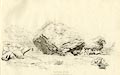
Plate 42 in Sixty Studies from Nature, 1810. No. 42. BOWDER STONE. Mr. Pocklington, who is now the proprietor of Bowder Stone, has pulled down the walls with which it was heretofore encumbered, and thereby rendered it an excellent painter's study. Bowder Stone is five miles from Keswick, on the road to Rosthwaite. size: wxh, image = 66x39cm (about) source type = Green 1810 (plate 42) (Armitt Library : A6641.42) |
|
Print, soft ground etching, Folly Bridge in Borrowdale, Cumberland, by
William Green, Ambleside, Westmorland, 1810.
Plate 43 in Sixty Studies from Nature, 1810. No. 43. FOLLY BRIDGE, IN BORROWDALE. The source of the river passing under this bridge is in Sprinkling Tarn, which, decending the mountain Sprinkling, unites itself with Sty Head Tarn; and having reached the valley, winds between the village of Seathwaite and the Black Lead Mines, to Folly Bridge, which is half a mile from Rosthwaite. ... size: wxh, image = 63x42cm (about) source type = Green 1810 (plate 43) (Armitt Library : A6641.43) |
|
Print, soft ground etching, Birch Trees in Coom Gill, ?Above Derwent,
Cumberland, by William Green, Ambleside, Westmorland, 1808.
Plate 44 in Sixty Studies from Nature, 1810. No. 44. BIRCH TREES, IN COOM GILL. Coom Gill is engulphed in fantastic scenery... On this stream, and about two miles from Rosthwaite, is a mill, which has furnished a subject for the smaller series of engravings, published in 1809, and the birch trees are not much higher than the mill. size: wxh, image = 65x43cm (about) source type = Green 1810 (plate 44) (Armitt Library : A6641.44) |
|
Print, soft ground etching, Stockley Bridge, Borrowdale, Cumberland, by
William Green, Ambleside, Westmorland, 1808.
Plate 45 in Sixty Studies from Nature, 1810. No. 45. STOCKLEY BRIDGE. This is the last bridge in Borrrowdale on the road from Rosthwaite to Wastdale Head; and is over a Gill, tumbling down the southern side of the mountain Sprinkling, which mountain is the back-ground of this scene. ... size: wxh, image = 64x41cm (about) source type = Green 1810 (plate 45) (Armitt Library : A6641.45) |
|
Print, soft ground etching, Over Beck Bridge in Wasdale, Nether Wasdale,
Cumberland, by William Green, Ambleside, Westmorland, 1808.
Yewbarrow behind. Plate 46 in Sixty Studies from Nature, 1810. No. 46. OVER BECK BRIDGE, IN WASTDALE. The bridge on Over Beck is about twenty yards from the lake, and a mile from its head; a farm called Bowderdale, the only enclosed land on either side of the water, has for its boundaries on three sides, the lake, with Over Beck and Nether Beck: Bowderdale between these streams is about half a mile over. On the north of Over Beck, in a fine line rises the mountain Yew-barrow, which is the back-ground to the bridge, the bridge may likewise be so viewed as to have Gable or Scho-fell as distances. size: wxh, image = 64x37cm (about) source type = Green 1810 (plate 46) (Armitt Library : A6641.46) |
|
Print, soft ground etching, Wast Water, Nether Wasdale, Cumberland, by
William Green, Ambleside, Westmorland, 1808.
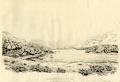
Plate 47 in Sixty Studies from Nature, 1810. No. 47. WAST WATER. ... The views on the travelled side of the lake certainly deserve great attention; the one here given is about a mile from its foot; and the road, which is of a fine elevation above the water, is seen meandering among the rocks to a good distance; Yew-barrow lies on the left, and under it, the enclosed lands of Bowderdale; part of the Screes are on the right; Wastdale Head at the end of the lake, by its enclosures, serves as a scale whereby to judge the vastness of the mountains; and over them is Great Gable, so called from its resemblance to the roof of a house: between Gable and Yew-barrow see a part of Kirk Fell, and between Gable and the Screes, Lingmell, from which rises Scho-fell, the summit of which cannot be seen from this place. ... size: wxh, image = 63x39cm (about) source type = Green 1810 (plate 47) (Armitt Library : A6641.47) |
|
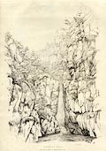
Print, soft ground etching, Stanley Gill, showing Stanley Force, Eskdale,
Cumberland, by William Green, Ambleside, Westmorland, 1808.
Plate 48 in Sixty Studies from Nature, 1810. No. 48. STANLEY GILL. ... if he should have the curiosity to see Stanley Gill, he may have access to it by applying at the hall [Dalegarth]; the waterfall part of the Gill, is more than half a mile on the left. ... The chasm is awfully sublime, the rocks rising almost perpendicular over their bases, from the grisly sides of which, impend trees in the richest wildness. - The mountains of Eskdale and Wastdale are fine distances, as seen out of the chasm on returning to the Hall; Scho-fell is the principal. size: wxh, image = 45x65cm (about) source type = Green 1810 (plate 48) (Armitt Library : A6641.48) |
|
Print, soft ground etching, Goldrill Crag on the River Duddon, Ulpha,
Cumberland, by William Green, Ambleside, Westmorland, 1808.
Plate 49 in Sixty Studies from Nature, 1810. No. 49. GOLD-RILL CRAG, ON THE RIVER DUDDON. The river Duddon divides Lancashire and Cumberland, from the county stones on Wrynose, to its junction with the Irish sea; consequently, the scene before us is in both counties. - This view is down the river; the left hand rock is in Lancashire, and Goldrill Crag, which is on the right, is in Cumberland. The Lancashire side of this river, from Broughton to Cockley Beck Bridge, which bridge is on the road from Ambleside to Wastdale, is chiefly the township of Seathwaite, a district deeply but charmingly entrenched among the mountains: Cockley Beck Bridge is four miles above Seathwaite chapel, and Goldrill Crag is half way between them. size: wxh, image = 67x44cm (about) source type = Green 1810 (plate 49) (Armitt Library : A6641.49) |
|
Print, soft ground etching, Vale of Langdale from Bays Brown, Great Langdale,
Westmorland, by William Green, Ambleside, Westmorland, 1810.
Plate 50 in Sixty Studies from Nature, 1810. No. 50. VALE OF LANGDALE, FROM BAYS BROWN. Bays Brown is a farm house, and the capital of a little manor, of which Mr. Atkinson is the lord; it lies in Langdale, on the opposite side of the valley to the chapel. - Pavey Ark is that sublime rock which rises above Stickle Tarn: The houses between the trees are called Oak How, on a green hill above which, the next view, No. 51, is taken. ... size: wxh, image = 64x41cm (about) source type = Green 1810 (plate 50) (Armitt Library : A6641.50) |
|
Print, soft ground etching, Langdale Pikes from Oak How, Great Langdale,
Westmorland, by William Green, Ambleside, Westmorland, 1809.
Plate 51 in Sixty Studies from Nature, 1810. No. 51. LANGDALE PIKES, FROM OAK HOW. Oak How is near six miles from Ambleside. Mill Beck House is not seen here, being hid by the foot of the mountain on the left; it is likewise higher in the valley than the house seen under the Pikes. - Pavey Ark, in the last range of distance, is over the foreground rock on the right; and the greatest part of the line traversed to and from the Tarn, may be traced on this print, by such as marked their steps with attention; it is chiefly the beginning and end of this devious way that cannot be seen from this point. size: wxh, image = 63x40cm (about) source type = Green 1810 (plate 51) (Armitt Library : A6641.51) |
|
Print, soft ground etching, Row Head in Langdale, Raw Head, Great Langdale,
Westmorland, by William Green, Ambleside, Westmorland, 1809.
Plate 52 in Sixty Studies from Nature, 1810. No. 52. ROW HEAD, IN LANGDALE Row Head is on the opposite side of the Langdale valley to Oak How, and in the distance are the Pikes so often spoken of before. size: wxh, image = 64x45cm (about) source type = Green 1810 (plate 52) (Armitt Library : A6641.52) |
|
Print, soft ground etching, Langdale Head, Great Langdale, Westmorland, by
William Green, Ambleside, Westmorland, 1809.
Probably Bow Fell centre beckground. Plate 53 in Sixty Studies from Nature, 1810. No. 53. LANGDALE HEAD. This view of the high end of the vale of Langdale, is taken near a farm called Side House, which is about seven miles from Ambleside: The pointed distant summit is Bow Fell, and the middle mountain on the right is the base of Langdale Pikes. size: wxh, image = 64x39cm (about) source type = Green 1810 (plate 53) (Armitt Library : A6641.53) |
|
Print, soft ground etching, Gimmer Crag, Great Langdale, Westmorland, by
William Green, Ambleside, Westmorland, 1809.
Plate 54 in Sixty Studies from Nature, 1810. No. 54. GIMMER CRAG, IN LANGDALE. This view of the Pikes is from the common, a mile above Wall End, and nine or ten miles from Ambleside - Gimmer Crag is that grand surface of rock which rises to an apex in the middle of the distance. - This view of Langdale Pikes bears a considerable resemblance to the Screes on Wast Water. The road to Wastdale, over Langdale Head, and to Borrowdale, by the Stake, is between the foot of Bow Fell, (which foot is the middle distance) and the base of the Pikes. size: wxh, image = 63x40cm (about) source type = Green 1810 (plate 54) (Armitt Library : A6641.54) |
|
Print, soft ground etching, Dove Crag in Hartsope, Patterdale, Westmorland,
by William Green, Ambleside, Westmorland, 1808.
Plate 55 in Sixty Studies from Nature, 1810. No. 55. DOVE CRAG, IN HARTSHOPE. Those who visit Ulls Water from Ambleside, on travelling seven miles from that place, pass by Brother Water, which is in Hartshope. The torrent, some of which is here represented, falls into that little lake near Hartshope Hall, about two miles below the place where this view was taken - the grand rock in the background is called Dove Crag. size: wxh, image = 64x42cm (about) source type = Green 1810 (plate 55) (Armitt Library : A6641.55) |
|
Print, soft ground etching, Vale of Patterdale, Westmorland, by William
Green, Ambleside, Westmorland, 1808.
Plate 56 in Sixty Studies from Nature, 1810. No. 56. THE VALE OF PATTERDALE. The vale of Patterdale lies on the head of Ulls Water. size: wxh, image = 65x43cm (about) source type = Green 1810 (plate 56) (Armitt Library : A6641.56) |
|
Print, soft ground etching, Patterdale Church, St Patrick's Church,
Patterdale, Westmorland, by William Green, Ambleside, Westmorland, 1809.
Plate 57 in Sixty Studies from Nature, 1810. No. 57. PATTERDALE CHURCH. This view of Patterdale Church, with the Glenridden mountains, was taken from the window of one of the lodging rooms at the inn at Patterdale, excepting the foreground of rocks, which was brought from the back of the house. size: wxh, image = 63x40cm (about) source type = Green 1810 (plate 57) (Armitt Library : A6641.57) |
|
Print, soft ground etching, Yew Tree in Patterdale Church Yard, St Patrick's
Church, Patterdale, Westmorland, by William Green, Ambleside, Westmorland,
1808.
Plate 58 in Sixty Studies from Nature, 1810. No. 58. YEW TREE IN PATTERDALE CHURCH-YARD. This Yew Tree, picturesque in ruin, is said, formerly, to have shaded considerably more ground than it does at present, which is probable from its trunk being somewhat disproportioned to its branches; the church and the tree are about a quarter of a mile from the inn on the road to the lake. size: wxh, image = 62x43cm (about) source type = Green 1810 (plate 58) (Armitt Library : A6641.58) |
|
Print, soft ground etching, Farm House at Glen Coin, Patterdale, Westmorland,
by William Green, Ambleside, Westmorland, 1808.
Plate 59 in Sixty Studies from Nature, 1810. No. 59 and 60. GLEN COIN. Glen Coin is a farm house, belonging to His Grace the Duke of Norfolk. The building itself is well formed for the purpose of an artist, and age has given more interest to the form, by planting mosses and other vegetables upon it; the hand of time has likewise been judiciously at work with his pencil, his palette being set with all the hues of nature. ... size: wxh, image = 62x44cm (about) source type = Green 1810 (plate 59) (Armitt Library : A6641.59) |
|
Print, soft ground etching, Glen Coin, Patterdale, Westmorland, by William
Green, Ambleside, Westmorland, 1808.
Plate 60 in Sixty Studies from Nature, 1810. No. 59 and 60. GLEN COIN. Glen Coin is a farm house, belonging to His Grace the Duke of Norfolk. The building itself is well formed for the purpose of an artist, and age has given more interest to the form, by planting mosses and other vegetables upon it; the hand of time has likewise been judiciously at work with his pencil, his palette being set with all the hues of nature. By the side of this building runs a brook dividing Westmorland from Cumberland, and over the brook is a picturesque bridge, which bridge is represented in the last of this series of prints. ... size: wxh, image = 68x45cm (about) source type = Green 1810 (plate 60) (Armitt Library : A6641.60) |