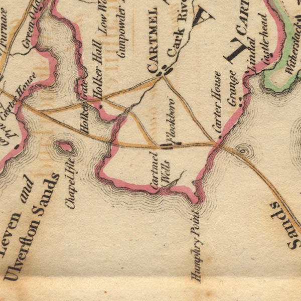
 West 1784 map SD37


|

|
|
|
gazetteer links places may or may not be labelled on the map |
||

|
-- Cartmel -- "CARTMEL" |
|
|
|
-- Chapel Island |
|
|
|
-- Eea, River |
|
|
|
-- Flookburgh |
|
|
|
-- Grange-over-Sands |
|
|
|
-- Guides Farm |
|
|
|
-- Holker Hall |
|
|
|
-- Holy Well |
|
|
|
-- Humphrey Head Point |
|
|
|
-- Kent Estuary |
|
|
|
-- Lancaster Sands |
|
|
|
-- Leven Estuary |
|
|
|
-- Lindale |
|
|
|
-- Sand Gate |
|
|
|
-- Ulverston Sands -- "Leven and Ulverston Sands" |
|
|
civil parishes The area roughly includes parts of parishes:- Urswick Aldingham Lower Holker Lower Allithwaite Egton with Newland Ulverston Broughton East Grange-over-Sands |
||
|
|
||
|
|
Lakes Guides menu. | |