 Speed 1611 (Wmd) SD69


|

|
|
|
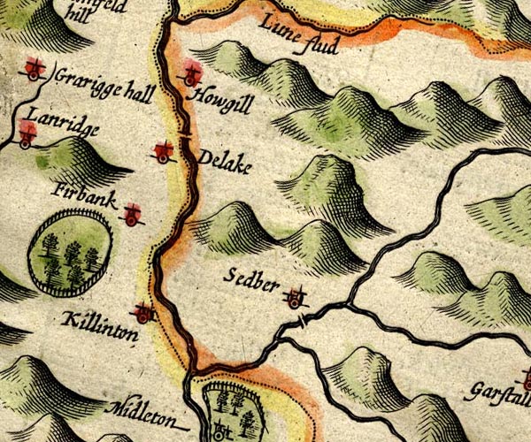
gazetteer links places may or may not be labelled on the map |
||

|
-- Clough River |
|
|
|
-- Dee, River |
|
|
|
-- Dillicar -- "Delake" |
|
|
|
-- Firbank -- "Firbank" |
|
|
|
-- Howgill -- "Howgill" |
|
|
|
-- Killington -- "Killinton" |
|
|
|
-- Lune, River -- "Lune flud" |
|
|
|
-- Rawthey, River |
|
|
|
-- Sedbergh New Bridge (?) |
|
|
|
-- Sedbergh -- "Sedber" |
|
|
civil parishes The area roughly includes parts of parishes:- Orton S Grayrigg Killington Firbank Lambrigg Middleton Tebay Dent Ravenstonedale Garsdale Sedbergh |
||
|
|
||
|
|
Lakes Guides menu. | |