item:- Threlkeld Mining Museum : no id 1
image:- © see bottom of page
 WHE1.jpg
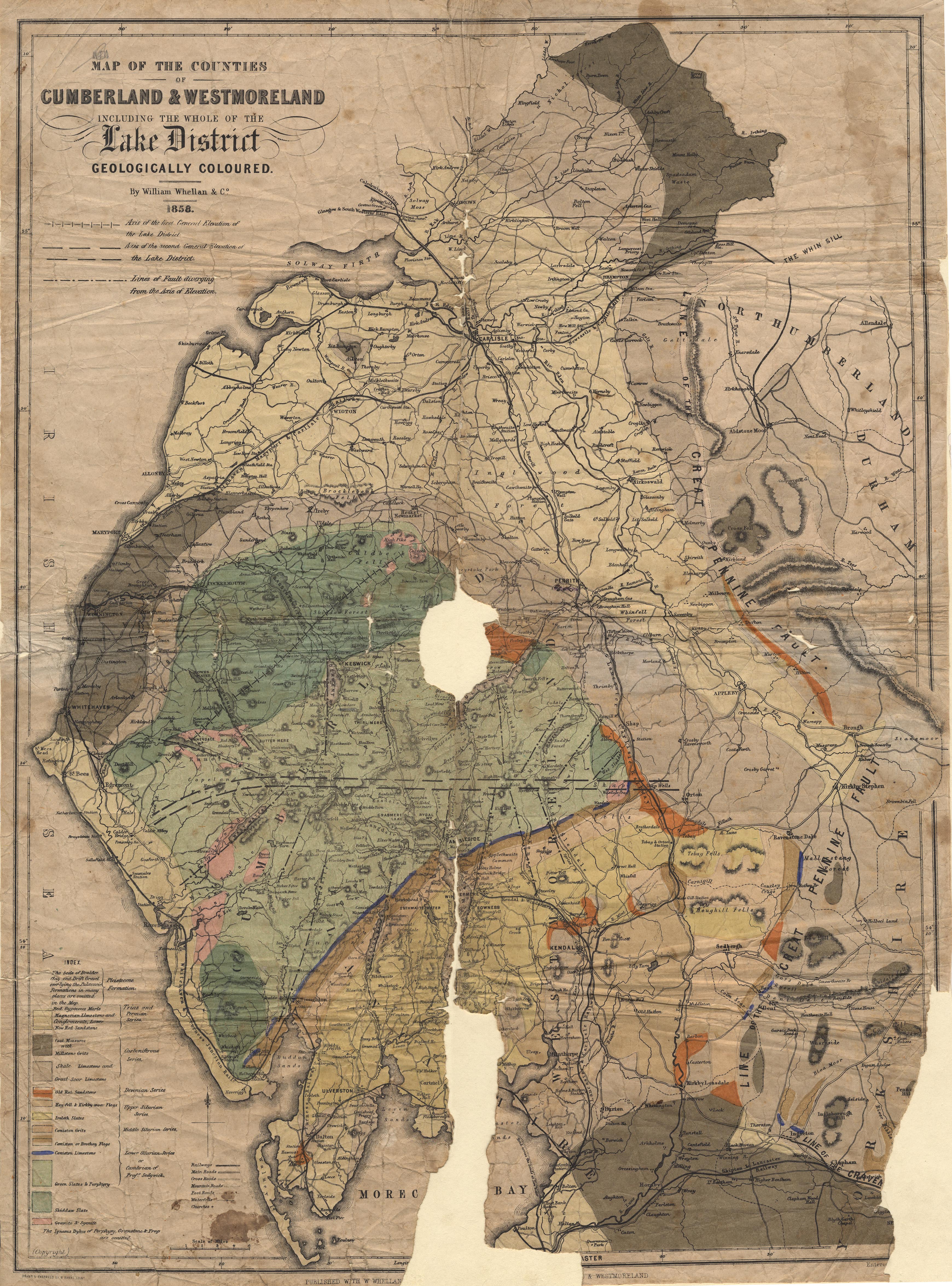
Geological map, Map of the Counties of Cumberland and
Westmoreland ... Geologically Coloured, scale about 3.5 miles to
1 inch, drawn and engraved by W Banks, Edinburgh, Lothian,
published by William Whellan and Co, 1858.
 Lakes Guides menu.