 Cumberland and Westmorland

|

|
|
|
map type:- Thurnam 1910s-20s map 2 |
|
|
|
Map, Cumberland and Westmorland, scale about 11.5 miles
to 1 inch, by W and A K Johnston, Edinburgh, published by
Charles Thurnam and Sons, Carlisle, Cumberland 1910s-20s.
Included on pages 32-33 of Cumberland its Geography and History for Use in Schools. |
||
|
(example JandMN (270_2))
|
||
| map feature:- | up is N & scale line & lat and long scales & sea plain & coast line & rivers & lakes & relief (minimal) & hill hachuring & county & settlements | |
| inscription:- |
printed lower left
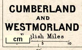
CUMBERLAND / AND / WESTMORLAND |
|
| inscription:- |
printed bottom left, right
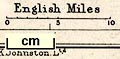
W. & A. K. Johnston Ltd. / Edinburgh & London |
|
| wxh, sheet:- | 18.5x24cm | |
| wxh, map:- | 147x203mm | |
| inscription:- |
printed with scale line
English Miles |
|
| scale line:- | 10 miles = 22.2 mm | |
| scale:- | 1 to 720000 ? (1 to 724930 from scale line) | |
|
||
| sources:- |
JandMN Collection |
|
| items seen (illustrated items in bold):- | ||

|
JandMN (270_2) -- map -- Cumberland and Westmorland | |