 Ordnance Survey Atlas of England and Wales

|

|
|
|
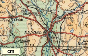
map type:- OS 1922 |
|
|
|
Maps, Ordnance Survey Atlas of England and Wales, Quarter
Inch series, scale 4 miles to 1 inch, published by the
Ordnance Survey, Southampton, Hampshire, 1922.
Parts of maps 2, 3 and 4 show Westmorland Cumberland, etc now Cumbria. |
||
|
(map example Hampshire Museums : CRH1963.26)
|
||
| map feature:- | compass rose (plain, with magnetic declination) & index grid (A..E 1..14 each page) & lat and long scales & depth soundings & relief & contours (200ft intervals, coloured relief) & layer colouring & rivers & settlements & roads & railways & woods & forests & windmills & county & scale line & table of symbols | |
| inscription:- |
printed title page
GR / ORDNANCE SURVEY ATLAS / OF / ENGLAND & WALES / QUARTER INCH TO THE MILE / Printed at the Ordnance Survey Office Southampton / Crown Copyright Reserved / 1922 / Price 30/- net. |
|
| scale:- | 1 to 253440 ? (nominal) | |
| sources:- |
HMCMS Map Collection |
|
| items seen (illustrated items in bold):- | ||

|
Hampshire Museums : CRH1963.26 -- atlas -- Ordnance Survey Atlas of England and Wales | |