 Cumberland, Furness and Westmorland

|

|
|
|
map type:- Odhams 1948 map |
|
|
|
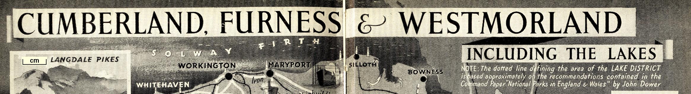
Pictorial map, halftone print, Cumberland, Furness and
Westmorland, including The Lakes, scale about 7.5 miles to 1
inch, published by Odhams Press, Long Acre, London, 1948.
Included in The English Counties, editor C E M Joad. |
||
|
(example JandMN (385_1))
|
||
| map feature:- | compass rose & up is NW (WNW) & scale line & sea illustrated (to look like sea) & coast line & rivers & lakes & relief & hillocks (modern version) & county & settlements & roads & railways & vignettes | |
| inscription:- |
printed top
CUMBERLAND, FURNESS & WESTMORLAND / INCLUDING THE LAKES / ... |
|
| wxh, map:- | 298x223mm | |
| inscription:- |
printed with scale line
Miles |
|
| scale line:- | 10 miles = 33.3 mm | |
| scale:- | 1 to 480000 ? (1 to 483286 from scale line) | |

|
||
| sources:- |
JandMN Collection |
|
| items seen (illustrated items in bold):- | ||

|
JandMN (385_1) -- pictorial map -- Cumberland, Furness and Westmorland | |