 Map to McMechan's Railway Guide

|

|
|
|
map type:- McMechan 1910s |
|
|
|
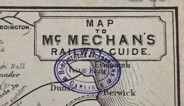
Railway map, Map to McMechan's Railway Guide, N of
England and S of Scotland, scale about 22.5 miles to 1 inch,
published by T McMechan, Wigton, Cumberland, 1910s?
|
||
|
(example Carlisle Library (171))
|
||
| map feature:- | plain cartouche & up is N & scale line & sea plain & coast form lines & rivers & lakes & county & settlements & railways | |
| inscription:- |
printed upper right, plain cartouche
MAP / TO / Mc.MECHAN'S / RAILWAY GUIDE. |
|
| inscription:- |
printed with scale line
STATUTE MILES |
|
| wxh, sheet:- | 14x21.5cm | |
| wxh, map:- | 127x198mm | |
| scale line:- | 50 miles = 56.3 mm | |
| scale:- | 1 to 1400000 ? (1 to 1429258 from scale line) | |

|
||
| sources:- |
Carlisle Library Maps |
|
| items seen (illustrated items in bold):- | ||

|
Carlisle Library : Map 96 -- railway map -- Map to McMechan's Railway Guide | |
|
|
Carlisle Library : Map 97 -- railway map -- Map to McMechan's Railway Guide | |