 Parte Settentrionale dell' Inghilterra

|

|
|
|
map type:- Marmocchi 1839 |
|
|
|
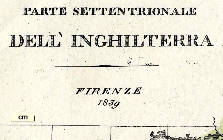
Map, Parte Settentrionale dell' Inghilterra, the North
Part of England, scale about 21 miles to 1 inch, by
Marmocchie, Florence, Italy, 1839 edn 1842.
The map is a later version of the map by Carli? The flag, upper right, is labelled La segna della Squadra Azzurra; it appears to be the flag of the blue squadron, ?Azores Squadron, of the english navy. |
||
|
(example private collection (94))
|
||
| map feature:- | up is N & scale line & lat and long scales (conical projection, longitude W from London and E from Isola dell' Ferro ? in the Canaries) & lat and long grid & sea plain & coast shaded & rivers & lakes & county & settlements & roads | |
| inscription:- |
printed upper left
PARTE SETTENTRIONALE / DELL' INGHILTERRA / FIRENZE 1839 |
|
| inscription:- |
printed lower right
Tav. XLVII |
|
| wxh, map:- | 313x226mm | |
| inscription:- |
printed above English scale line
Miglia statutarie d' Inghilterr. di 69 1/2 al' grade |
|
| scale line:- | 60+10 miles = 86.2 mm | |
| scale:- | 1 to 1400000 ? (1 1360892 to from scale line) | |
|
||
| sources:- |
private collection |
|
| items seen (illustrated items in bold):- | ||

|
private collection (94) -- map -- Parte Settentrionale dell' Inghilterra -- North Part of England | |