 Nautical Descriptions of the West Coast of Great
Britain
Nautical Descriptions of the West Coast of Great
Britain

|

|
|
|
map type:- Mackenzie 1776 |
|
|
|
Charts, and sailing directions, Nautical Descriptions of
the West Coast of Great Britain, Bristol Channel to Cape
Wrath, by Murdoch Mackenzie, published London, 1776.
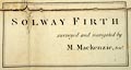
The charts and pages that concern Cumbria are:- Chart 10 and pp.17-18 - Formby Point to Walney Island; Chart 11 and pp.18-19 - Piel of Foudray to St Bees Head; Chart 13 and pp.21-22 - Mouth of the Solway Firth; Chart 14 and pp.22-24 - Solway Firth. |
||
|
(example National Library of Scotland : EU29.M)
|
||
| inscription:- |
printed title page
NAUTICAL DIRECTIONS / OF THE / WEST COAST / OF / GREAT BRITAIN / FROM / BRISTOL CHANNEL TO CAPE-WRATH / (The most North-western Promontory of Scotland); / ADAPTED TO / The several Charts in the MARITIM SURVEY of the West of GREAT BRITAIN. / CONTAINING / A particular Account of the TIDES, ROCKS, SHOALS, CHANNELS, ANCHORING- / PLACES, and HARBOURS, along that COAST, with suitable SAILING- / DIRECTIONS interspersed. / To which is prefixed / The Principal OBSERVATIONS and MEASUREMENTS, on / which the SURVEY was grounded. / By MURDOCH MACKENZIE, Sen. // LONDON : / Printed for the Author; and for KENNETH MACKENZIE of New London-Street, Hart-Street; and his eldest Son / MURDOCH MACKENZIE; and sold (together with the Charts) by MOUNT and PAGE, on Tower-Hill; / SAYER and BENNET, in Fleet-Street; JEFFERIES and FADEN, in the Strand, near Charing-Cross; / and DURY in Duke's-Court, Leicester-Fields. / MDCCLXXVI. |
|
|
||
| sources:- |
National Library of Scotland Carlisle Library Maps |
|
| items seen (illustrated items in bold):- | ||

|
Carlisle Library : Map 327 -- chart -- Solway Firth | |
|
|
National Library of Scotland : EU29.M -- sailing directions -- Nautical Descriptions of the West Coast of Great Britain | |