 New and Original Hydrographic Survey of the North and St
George's Channels
New and Original Hydrographic Survey of the North and St
George's Channels

|

|
|
|
map type:- Huddart 1794 |
|
|
|
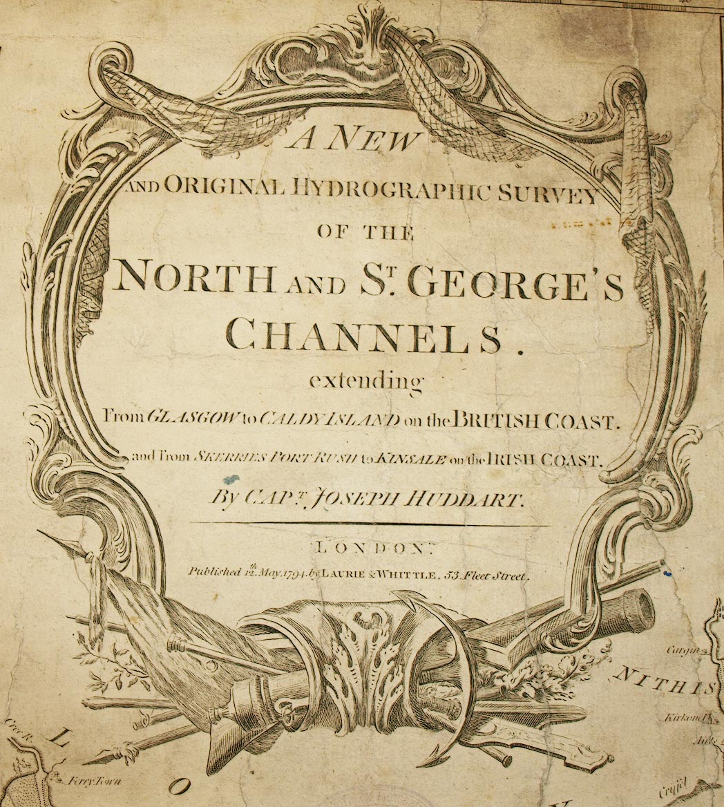
Chart, A New and Original Hydrographic Survey of the
North and St George's Channels, scale about 4.5 miles to 1
inch, by Joseph Huddart, published by Laurie and Whittle, 53
Fleet Street, London, 1794.
Part 1 includes from the Solway Firth to Preston |
||
|
(example Carlisle Library (38))
|
||
| map feature:- | compass rose & up is N & rhumb lines & magnetic deviation & lat and long scales & sea plain & sandbanks & foreshore sands & depth soundings & tidal flows & anchorages & lighthouses & coast views & county & settlements | |
| inscription:- |
printed upper left
A NEW / AND ORIGINAL HYDROGRAPHIC SURVEY / OF THE / NORTH AND ST. GEORGE'S CHANNELS. / extending / From GLASGOW to CALDY ISLAND on the BRITISH COAST. / and from SKERRIES POINT, PORT RUSH to KINSALE on the IRISH COAST. / BY CAPT. JOSEPH HUDDART. / LONDON. / Published 12th. May, 1794, by LAURIE & WHITTLE, 53, Fleet Street. |
|
| wxh, map:- | 494x778mm | |
| inscription:- |
printed with scale line
Scale of Nautic Leagues 20 to a Degree. |
|
| scale line:- | 10 leagues = 197.0 mm | |
| scale:- | 1 to 290000 ? (1 to 285968 from 1d latitude = 389.1 mm) | |
| sources:- |
Carlisle Library Maps |
|
| items seen (illustrated items in bold):- | ||

|
Carlisle Library : Map 90 -- chart -- New and Original Hydrographic Survey of the North and St George's Channels -- North and St George's Channels | |