 Housman 1800 map 1

|

|
|
|
map type:- Housman 1800 map 1 |
|
|
|
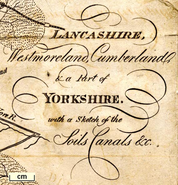
Soil map, Lancashire, Westmoreland, Cumberland and a Part
of Yorkshire, with a Sketch of the Soils, Canals, etc, scale
about 8.5 miles to 1 inch, engraved by J Lowes, published by
F Jollie, Carisle, Cumberland, and C Law, Ave Maria Lane,
London, 1800.
Included in A Descriptive Tour, and Guide to the Lakes, Caves, Mountains ..., by John Housman; published 1800-21. |
||
|
(example Carlisle Library (30))
|
||
| map feature:- | north point & up is N (NNE) & scale line & sea plain & coast form lines & rivers & lakes & relief & hill hachuring & county & settlements & roads & canals & soils | |
| inscription:- |
printed
LANCASHIRE, / Westmoreland, Cumberland, / & a part of / YORKSHIRE. / With a Sketch of the / Soils Canals &c. |
|
| inscription:- |
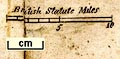
printed with scale line
English Statute Miles |
|
| scale line:- | 10 miles = 30.0 mm | |
|
||
|
||
| sources:- |
Bicknell 1990 Carlisle Library JandMN Collection |
|
| items seen (illustrated items in bold):- | ||

|
Carlisle Library : Map 76 -- map -- Lancashire, Westmoreland, Cumberland and a Part of Yorkshire, with a Sketch of the Soils, Canals, etc | |
|
|
Carlisle Library : Map 77 -- map -- Lancashire, Westmoreland, Cumberland and Part of Yorkshire, with a sketch of the Soils Canals etc | |
|
|
JandMN (233_1) -- map -- Lancashire, Westmoreland, Cumberland and Part of Yorkshire, with a sketch of the Soils Canals etc | |