 Manchester Corporation Water Works

|

|
|
|
map type:- Harwood 1895 map |

|
|
|
Map, colour lithograph, Manchester Corporation Water
Works, plan showing Works at Lake Thirlmere, Cumberland,
scale about 3 inches to 1 mile, and a map of the Line of
Aqueduct from Thirlmere, Cumberland to Manchester,
Lancashire, scale about 5 inches to 1 mile, published by
Henry Blacklock and Co, Albert Square, Manchester, 1895.
The original lake is plotted, and the proposed extent when the level is raised by 20 and 50 feet. The maps are included in the History and Description of the Thirlmere Water Scheme, by Sir John James Harwood. |
||
|
(example map Armitt Library : A660.3)
|
||
| inscription:- |
printed upper middle
MANCHESTER CORPORATION WATER WORKS. / PLAN SHOWING WORKS AT LAKE THIRLMERE. |
|
| inscription:- |
printed bottom
HENRY BLACKLOCK & Co. COLOUR PRINTERS MANCHESTER |
|
| wxh, sheet:- | 49x22cm | |
| wxh, map:- | 453x196mm | |
| inscription:- |
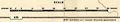
printed with scale line
SCALE / CHAINS |
|
| scale line:- | 80+10 chains = 82.9 mm | |
| scale:- | 1 to 22000 ? (1 to 21840 from scale line) | |
|
||
| sources:- |
Armitt Library |
|
| items seen (illustrated items in bold):- | ||

|
Armitt Library : A660.3 -- map -- Manchester Corporation Water Works -- Works at Lake Thirlmere | |
|
|
Armitt Library : A660.13 -- map -- Manchester Corporation Water Works -- Line of Aqueduct from Thirlmere to Manchester | |