 Garnett 1850s-60s B

|

|
|
|
map type:- Garnett 1850s-60s B |
|
|
|
Map of the English Lake District, scale about 3.5 miles
to 1 inch, published by J Garnett, Windermere, Westmorland,
1850s-60s?
Included in a pocket at the back of A Guide to the English Lake District, by a Cambridge Man, published by John Garnett and by Simpkin, Marshall and Co, London. Included as a two sided map in The Lake District of England. |
||
|
(example map JandMN (149_1))
|
||
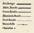
| map feature:- | folded (2x4) & north point & up is N & scale line & table of symbols & sea plain & coast form lines & rivers & lakes & relief & hill hachuring & forests & parks & county & settlements & roads & railways & canals | |
| inscription:- |
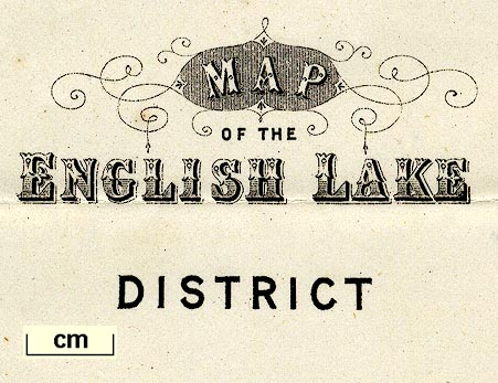
printed lower left
MAP / of the / ENGLISH LAKE / DISTRICT |
|
| inscription:- |
printed bottom
PUBLISHED BY JOHN GARNETT, WINDERMERE. |
|
| inscription:- |
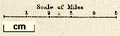
printed above scale line
Scale of Miles |
|
| wxh, sheet:- | 29.5x36.5cm | |
| wxh, map:- | 270x339mm | |
| scale line:- | 5 miles = 37.1 mm | |
| scale:- | 1 to 220000 ? (1 to 216893 from scale line) | |
|
||
|
||
| sources:- |
JandMN Collection Wordsworth Trust Collection |
|
| items seen (illustrated items in bold):- | ||

|
Dove Cottage : 2005.18.1.2 -- map -- Map of the English Lake District | |
|
|
JandMN (149_1) -- map -- Map of the English Lake District | |