 Plan of the City of Carlisle and Places Adjacent

|

|
|
|
map type:- Carlyle 1791 |
|
|
|
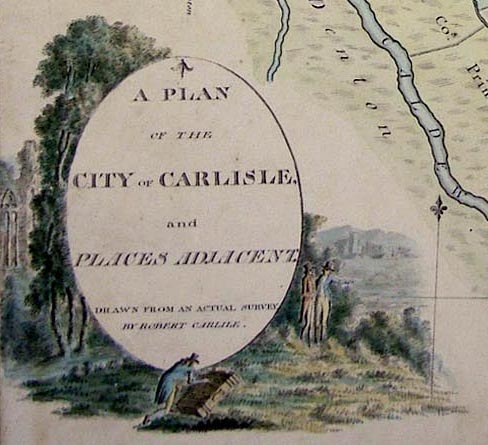
Map, watercolour painting, A Plan of the City of Carlisle
and Places Adjacent, Cumberland, by Robert Carlyle snr,
1791.
Included in an album of The Antiquities of the City of Carlisle. |
||
|
(example map Tullie House Museum : 1978.108.77.3)
|
||
| inscription:- |
inscribed bottom left
A PLAN OF THE CITY OF CARLISLE AND PLACES ADJACENT DRAWN FROM AN ACTUAL SURVEY BY ROBERT CARLILE |
|
| wxh, sheet:- | 32x42cm | |
| sources:- |
Tullie House Museum |
|
| items seen (illustrated items in bold):- | ||

|
Tullie House Museum : 1978.108.77.3 -- street map -- Plan of the City of Carlisle and Places Adjacent | |