 Butters 1803

|

|
|
|
map type:- Butters 1803 |
|
|
|
Maps, Westmoreland, scale about 11.5 miles to 1 inch, and
Cumberland, by R Butters, 22 Fetter Lane, Fleet Street,
London, 1803.
Published in 'An Atlas of England ... London. Printed and sold by R. Butters, No.22, Fetter Lane, Fleet Street.' 1803. The atlas has a map of England and Wales, upsidedown as many other maps are, there is a description of the posts roads, and a gazetteer; its size is 4 x 7 1/2 ins. Published in 'The Picture of England Illustrated with correct colour'd Maps of the several Counties. In two volumes By William Green ... London: Printed for J. Hatchard Bookseller to his Majesty, Piccadilly. 1804.' |
||
|
(example map Armitt Library : ALMC2008.14.48)
|
||
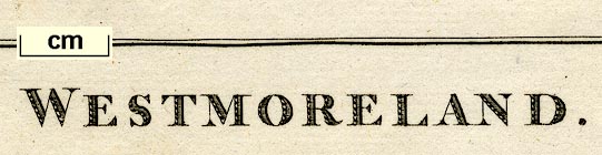
| map feature:- | north point (pointing S) & up is W & scale line & sea shaded & coast shaded & rivers & lakes & parks & county & settlements & roads | |
| inscription:- |
printed bottom
WESTMORELAND. |
|
| wxh, sheet:- | 11.5x18.5cm | |
| wxh, map:- | 90x120mm | |
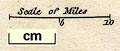
| inscription:- |
printed above scale line
Scale of Miles |
|
| scale line:- | 10 miles = 22.0 mm | |
| scale:- | 1 to 730000 ? (1 to 731520 from scale line wrongly assuming a statute mile) | |
|
||
| references:- |
Butters, R: 1803: Atlas of England ...: (London) Green, William: 1804: Picture of England Illustrated: Hatchard, J (London) |
|
| sources:- |
Chubb 1927 (CCCX) Armitt Library |
|
| items seen (illustrated items in bold):- | ||

|
Armitt Library : ALMC2008.14.48 -- map -- Westmoreland | |
|
|
Armitt Library : ALMC2008.14.49 -- map -- Westmoreland | |