 Bowen 1763

|

|
|
|
map type:- Bowen 1763 |
|
|
|
Map, Improved Map of the Counties of Cumberland and
Westmoreland, scale about 5.5 miles to 1 inch, derived from
a larger map by Bowen or Kitchin, by Emanuel Bowen, London,
about 1763; published 1763-1828.
Published in 'The Royal English Atlas: Being A New and Accurate Set of Maps Of All The Counties of South Britain, Drawn from Surveys, and the best Authorities; Divided into their respective Hundreds, And Exhibiting All The Cities, Towns, Villages, Churches, Chapels, &c. Particularly Distinguishing more Fully and Accurately the Church Livings, Than any other Maps hitherto Published. Adorned With Views of all the Cathedrals; And A Concise Description of each Diocese: Illustrated With Historical Extracts relative to the Government, Trade, Manufactures, and present State of the Cities, and principal Boroughs and Market Towns: Likewise: An Account of the Air, Soil, Natural Produce, and Commodities of every County. To the Whole is prefix'd, A General Map of England and Wales; Comprehending All The Direct And Principal Cross Roads: With many other Useful Particulars. And regulated by Astronomical Observations. By Emanuel Bowen, Geographer to His late Majesty, Thomas Kitchin, Geographer, and Others. The Whole Comprised in Forty-four Sheet Maps. London: Printed for Thomas Kitchin, on Holborn-Hill; Robert Sayer, in Fleet-Street; Carington Bowles, in St. Paul's Church-Yard; Henry Overton, without Newgate; Henry Parker, and John Bowles, in Cornhill; and John Ryall, in Fleet-Street,' about 1764. The atlas size is 12 x 18 1/2 ins; there are variant title pages listing publishers in different orders. The map is a reduced version of a map by Bowen or Kitchin published in the Large English Atlas, from the 1760 edition onwards; there is a vignette view of Carlisle Cathedral. Perhaps published in 'The English Atlas, or a complete set of maps of all the counties of England and Wales, containing all the cities, towns, parishes, rivers, roads, seats, and in general every other particular that is usually sought for or to be found in maps. The whole engraved in the neatest and most accurate manner, from drawings after actual surveys, and other the best authorities, by Thomas Kitchin; Emanuel Bowen, geographer to his majesty; and others. Lond. 1765. 4to. with a general description of the counties, and historical extracts relating to the trade &c. &c.' 1765. Published in 'The Royal English Atlas: Being A New And Accurate Set Of Maps Of All The Counties In England And Wales, Drawn From The Several Surveys which have been hitherto published, With A general Map of England, and Wales. From the latest and best Authorities. ... Containing all the Cities, Towns, Villages, and Churches, whether Rectories, Vicarages, or Chapels, many Noblemen's and Gentlemen's Seats, &c. &c. Each Map Is Illustrated With a General Description of the County, its Cities, Borough and Market Towns, the Number of Members returned to Parliament, Parishes, Houses, Acres of Land, &c. And Historical Extracts relative to the Trade, Manufactures, and Government of the Cities, and Principal Towns, and the present State of their Inhabitants, &c. By Emanuel Bowen, Geographer to His Majesty, Thomas Kitchin, and Others. London: Printed for and Sold by Carington Bowles, at his Map and Print Warehouse, at No.69, in St. Paul's Church Yard.' about 1778. Published in the same atlas 'Printed for R. Sayer and J. Bennett, map, Sea Chart, and Print-Sellers, in Fleet-Street.' about 1778. Published in 'The Royal English Atlas; Being A New and Accurate Set of Maps of all the Counties of South Britain, ... By Emanuel Bowen, Geographer to His late Majesty, Thomas Kitchin, Geographer, and Others. The Whole Comprised in Forty-four Sheet maps. London: Printed and Sold by Robert Wilkinson, at No.58. in Cornhill, Successor to Mr. John Bowles, deceased.' about 1780. The new maps include a 'Chart of Distances of all Cities and Chief Towns, 1775'. Published in 'The English Atlas; Or, A Set Of Maps Of All The Counties In England And Wales, Drawn From The Best Authorities; Containing All The Cities, Towns, Villages, and Churches, Chapels, Many Noblemen's and Gentlemen's Seats, &c. Each Map Is Illustrated With A General Description of the Borough and Market Towns; The Number of Members Returned to Parliament; Of Land, State Of Inhabitants, Etc., Etc., ... London, Sold by R. Martin, Bookseller, No.47, Great Queen Street, Lincoln's-Inn Fields.' about 1828. The 1828 atlas size is 11 1/4 x 18 1/2 ins. |
||
|
(map example Dove Cottage : 2007.38.31)
|
||
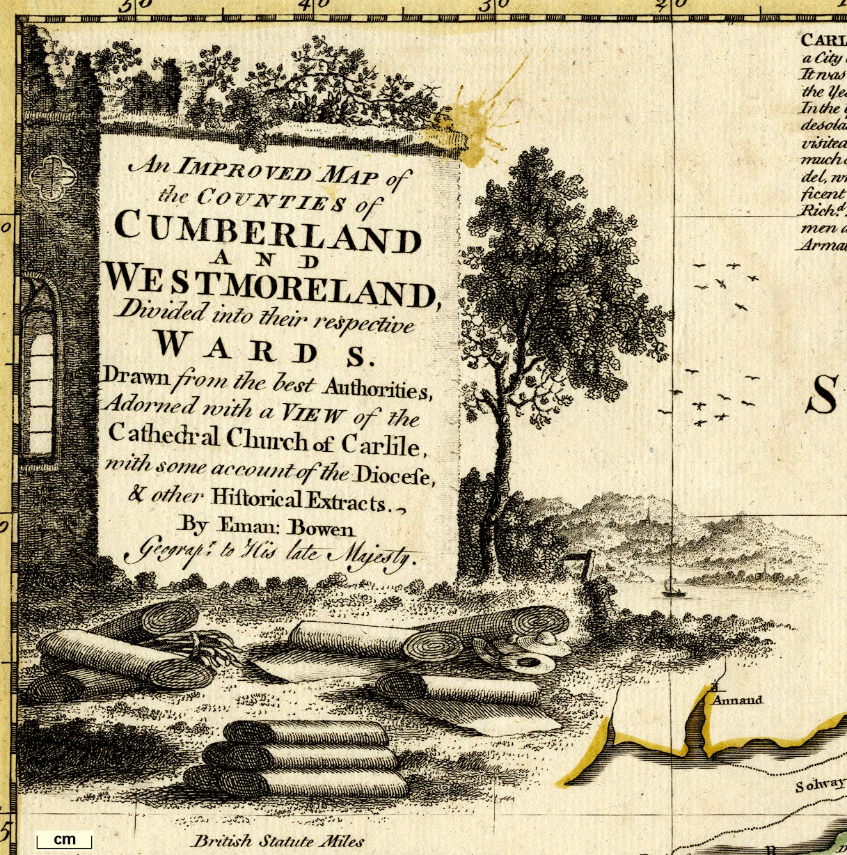
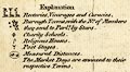
| map feature:- | monumental cartouche & vignettes & descriptive text & table of symbols & compass rose (aligned to lat and long grid) & up is N & scale line & lat and long scales (West Long. from London; rectangular projection) & lat and long grid & sea plain & coast shaded & rivers & bridges & lakes & relief & hillocks & woods & trees & forests & parks & county & wards (hundreds) & settlements & roads & post roads & road distances & market days | |
| inscription:- |
printed monumental cartouche, upper left
An IMPROVED MAP of / the COUNTIES of / CUMBERLAND / and / WESTMORELAND / Divided into their respective / WARDS. / Drawn from the best Authorities, / Adorned with a VIEW of the / Cathedral Church of Carlile, / with some account of the Diocese, / & other Historical Extracts. / By Eman : Bowen / Geograpr. to His late Majesty. a ruin in a scene with lake and mountains, bolts of woollen cloth, straw hats |
|
| inscription:- |
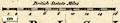
printed above scale line
British Statute Miles |
|
| wxh, sheet:- | 46x58cm | |
| wxh, plate:- | 418x517mm (?) | |
| wxh, map:- | 403x502mm | |
| scale line:- | 16 miles = 72.2 mm | |
| scale:- | 1 to 360000 ? (1 to 356641 from scale line) | |
| longitude, Kendal:- | 2d 50.8m W | |
|
||
|
||
| references:- |
Bowen, Emanuel & Kitchin, Thomas: 1763: Royal English Atlas:
Kitchin, Thomas & Sayer, Robert & Bowles, Carington &
Overton, Henry & Parker, Henry & Bowles, John & Ryall, John
(London) Kitchin, Thomas & Bowen, Emanuel: 1765: English Atlas: (London) Bowen, Emanuel & Kitchin, Thomas: 1778: Royal English Atlas: Bowles, Carington (London) Bowen, Emanuel & Kitchin, Thomas: 1778: Royal English Atlas: Sayer, R & Bennett, J (London) Bowen, Emanuel & Kitchin, Thomas: 1780: Royal English Atlas: Wilkinson, R (London) : 1828: English Atlas: Martin, R (London) Harley, J B (introduction) & Hodson, Donald (introduction): 1971: Royal English ATlas, The: David and Charles (Newton Abbot, Devon):: ISBN 0 7153 5100 1 |
|
| sources:- |
Chubb 1927 (CCXVIII) Hodson 1984 Wordsworth Trust Collection Carlisle Library Maps |
|
| items seen (illustrated items in bold):- | ||

|
Armitt Library : ALMC2008.14.121 -- map -- Improved Map of the Counties of Cumberland and Westmoreland -- Cumberland and Westmoreland | |
|
|
Carlisle Library : Map 9 -- map -- Improved Map of the Counties of Cumberland and Westmoreland | |
|
|
Dove Cottage : 2007.38.31 -- map -- Improved Map of the Counties of Cumberland and Westmoreland -- Cumberland and Westmoreland | |