 Map of the Roman Wall

|

|
|
|
map type:- Blair 1909 map |
|
|
|
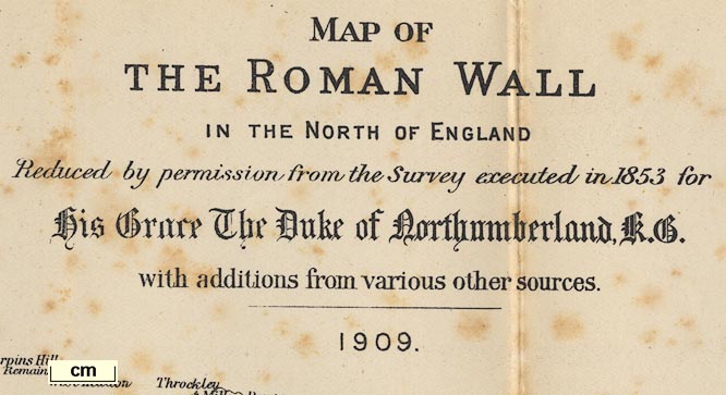
Map of the Roman Wall, in Cumberland and Northumberland,
scale about 2 miles to 1 inch, derived from a survey for the
Duke of Northumberland, 1853, by Robert Blair, 1909?
Included in the Handbook to the Roman Wall, by J Collingwood Bruce, 1863, 6th edn edited by Robert Blair, published by Andrew Reid and Co, Newcastle-upon-Tyne, Northumberland, 1909. |
||
| see:- | Bruce 1863 | |
| map feature:- | up is N & scale line & sea plain & coast line & coast form lines & rivers & county & settlements & roads & railways & antiquities | |
| inscription:- |
printed upper right
MAP OF / THE ROMAN WALL / IN THE NORTH OF ENGLAND / Reduced by permission from the Survey executed in 1853 for / His Grace The Duke of Northumberland, K.G. / with additions from various other sources. / 1909. |
|
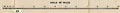
| scale line:- | 10+1 miles = 138.9 mm | |
|
||
|
||
| sources:- |
JandMN Collection |
|
| items seen (illustrated items in bold):- | ||

|
JandMN (84_1) -- map -- Map of the Roman Wall | |