 Bartholomew 1880s

|

|
|
|
map type:- Bartholomew 1880s |
|
|
|
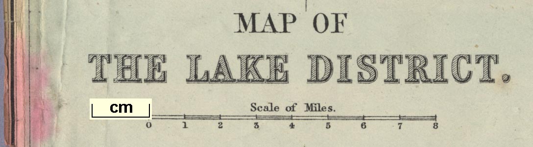
Map of The Lake District, in Cumberland, Westmorland, and
Lancashire, scale about 4 miles to 1 inch, by John
Bartholomew and Co, Edinburgh, Lothian, Scotland, about
1880s?
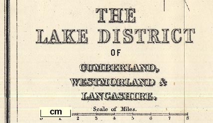
Published as 'THE LAKE DISTRICT OF CUMBERLAND, WESTMORLAND & LANCASHIRE.' facing page 1, in 'BLACK'S GUIDE TO THE ENGLISH LAKES OF CUMBERLAND AND WESTMORLAND / SIXTEENTH EDITION EDINBURGH ADAM AND CHARLES BLACK 1884'. This edition appears to be a lithographic reproduction, the area covered is slightly reduced. Published in a guidebook, 'The Concise Series of Guides, No.1. THE ENGLISH LAKE DISTRICT, INCLUDING FURNESS ABBEY, SHAP SPA, SEASCALE, ETC., ETC. With Map and Illustrations. LONDON:- GEORGE PHILIP & SON, 32, FLEET STREET. LIVERPOOL:- PHILIP, SON & NEPHEW, 45 TO 51, SOUTH CASTLE STREET. KENDAL:- T. WILSON, HIGHGATE. / AND THROUGH ALL BOOKSELLERS.' about 1895. This appears to be an engraving, not a lithograph. |
||
|
(map example JandMN (58_1))
|
||
| map feature:- | up is N & scale line & sea tinted & coast line & rivers & lakes & relief & hill hachuring & county & settlements & roads & railways & canals | |
| inscription:- |
printed lower left
MAP OF / THE LAKE DISTRICT. |
|
| inscription:- |
printed bottom right
J. Bartholomew. Edinr. |
|
| scale line:- | 8 miles = 48.6 mm | |
| scale:- | 1 to 260000 ? (1 to 264913 from scale line) | |
| wxh, map:- | 307x308mm | |
|
||
|
||
| sources:- |
JandMN Collection |
|
| items seen (illustrated items in bold):- | ||

|
JandMN (58_1) -- map -- Map of The Lake District | |
|
|
JandMN (59_1) -- map -- Lake District of Cumberland, Westmorland and Lancashire | |
|
|
JandMN (455_2) -- map -- Map of the Lake District | |