item:- JandMN : 270.2
image:- © see bottom of page
 THM3M2.jpg
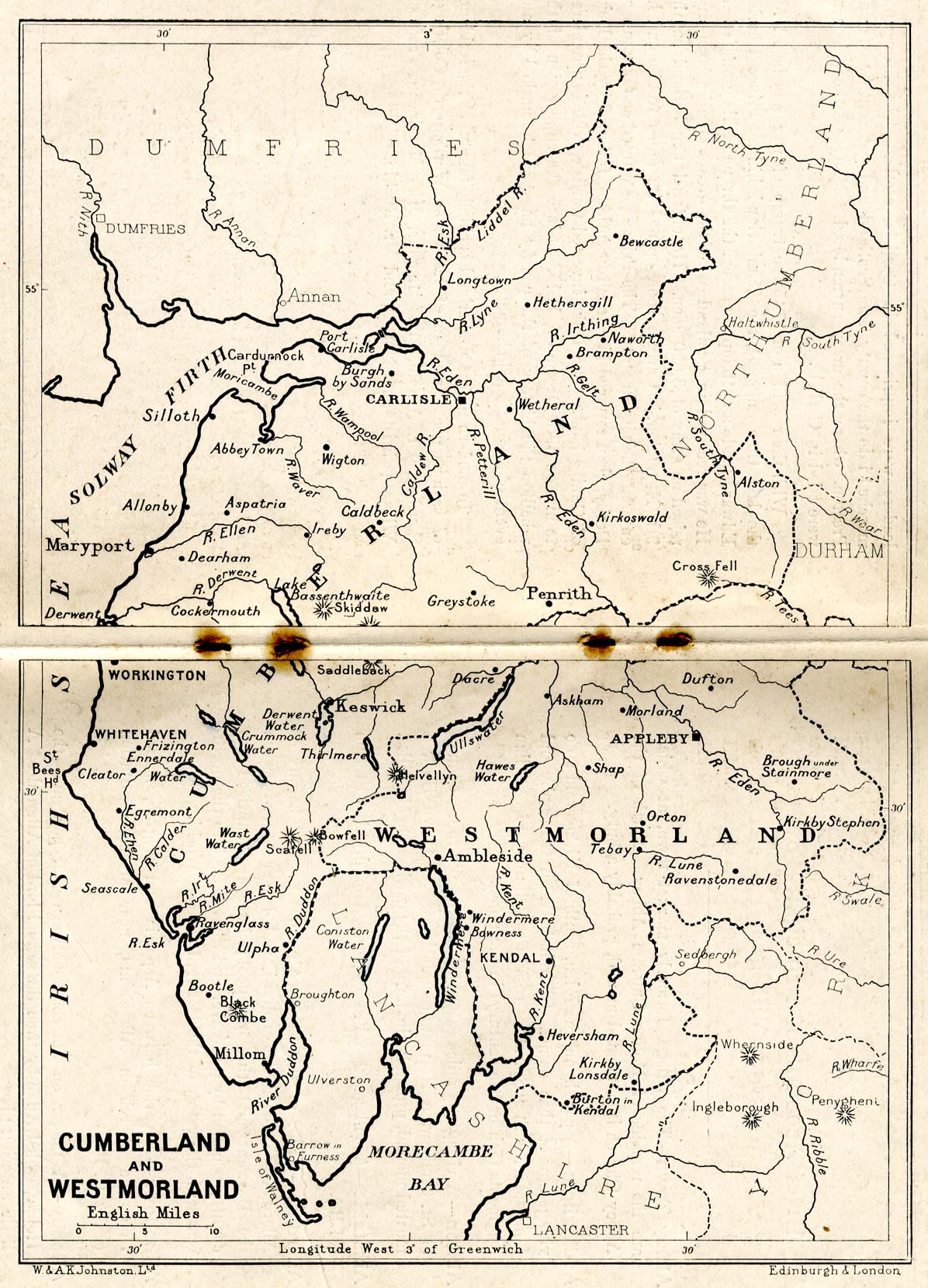
Map, uncoloured lithograph, Cumberland and Westmorland, scale
about 11.5 miles to 1 inch, by W and A K Johnston, Edinburgh,
published by Charles Thurnam and Sons, Carlisle, Cumberland
1910s-20s.
 Lakes Guides menu.