item:-
Armitt Library : 2008.14.74
image:-
©
see bottom of page
QBS7.jpg
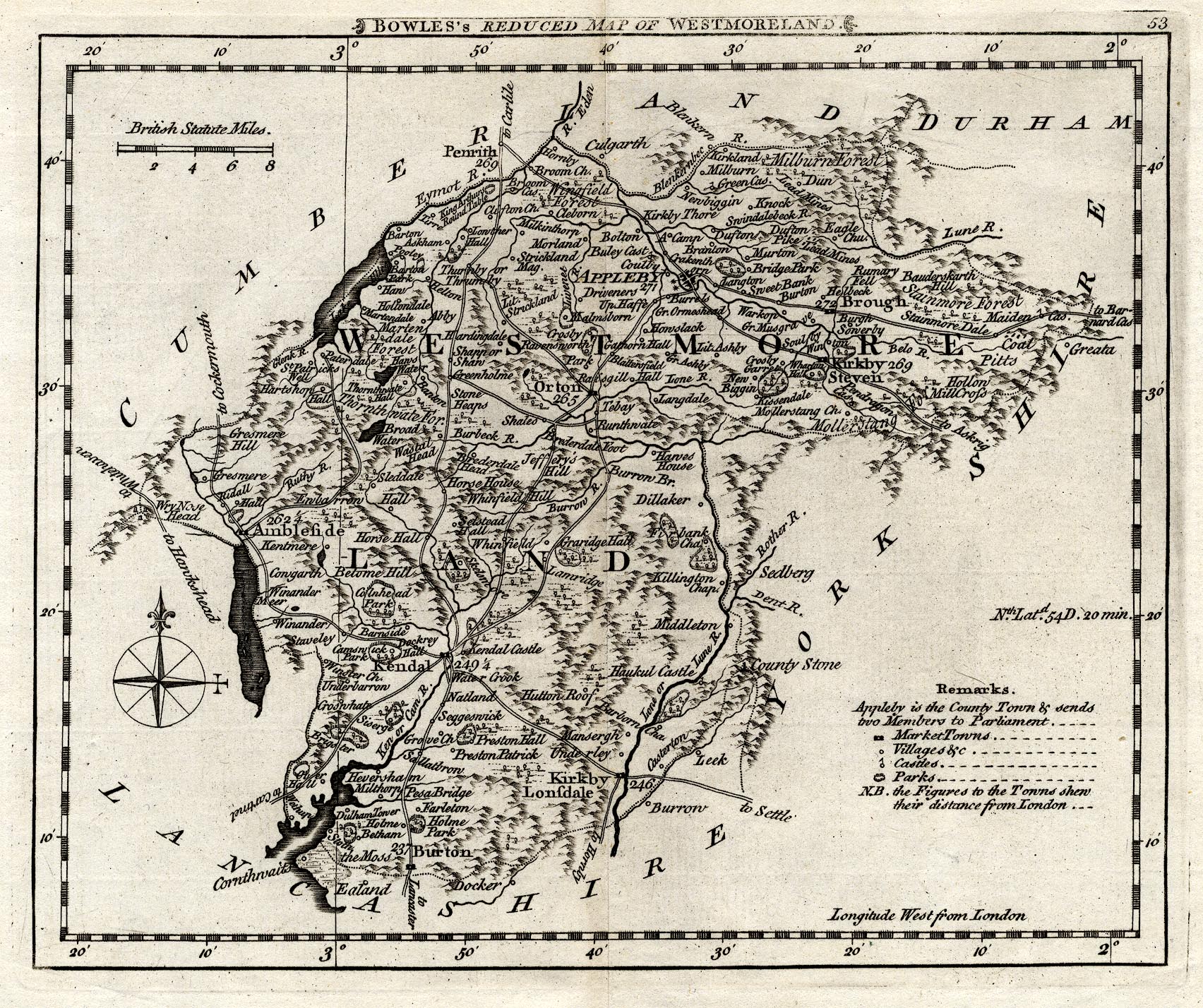
Map, uncoloured engraving, Bowles's Reduced Map of Westmoreland, scale about 7.5 miles to 1 inch, by Carington Bowles, 69 St Paul's Churchyard, London, 1785.
Lakes Guides menu.
 Lakes Guides menu.