 Millward and Dickinson 1737

|

|
|
|
item:- private collection (264) image:- © see bottom of page |
click to enlarge |
|
|
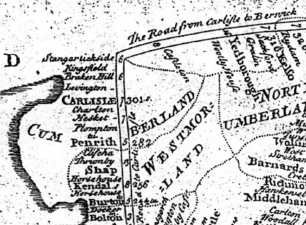
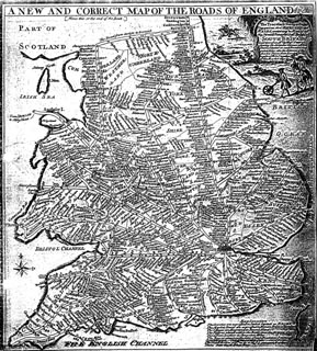
Road map, photocopy, diagram, A New and Correct Map of
Roads of England, probably published by T Millward and B
Dickinson, Inigo Jones's Head, Fleet Street, London, 1737.
Included in The Traveller's Guide or Pocket Companion |
||

|
Millward and Dickinson 1737 | |
| map feature:- | scroll cartouche & table of symbols & compass rose & up is N & sea plain & coast shaded & rivers & county & settlements & roads & road distances | |
| inscription:- |
printed plain cartouche, top
A NEW AND CORRECT MAP OF THE ROADS OF ENGLAND &c. |
|
| inscription:- |
printed scroll cartouche, upper right
The Traveller's Guide or Pocket Companion thro' ENGLAND and WALES, containing a Map of all the Direct and Principal Cross Roads of SOUTH BRITAIN laid down from Mr. Ogilby's Survey shewing the distances between the Towns situated on each Road in Computed Miles' also the distances of the Market Towns from London in measured Miles together with the Market days &c. |
|
| wxh:- | 27.5x31cm (approx) | |
|
||
|
|
notes | |