 Yates 1786

|

|
|
|
item:- National Library of Scotland : EME.s.55 image:- © National Library of Scotland |
click to enlarge |
|
|
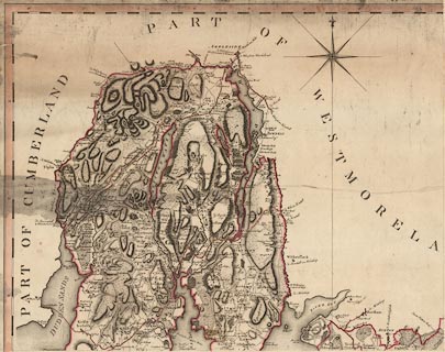
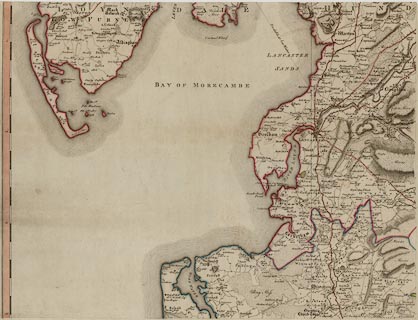
Map, hand coloured engraving, The County Palatine of
Lancaster, scale about 1 inch to 1 mile, by William Yates,
published, London, 1786.
|
||

|
Yates 1786 | |
| map feature:- | title cartouche & pictorial cartouche & table of symbols & compass rose & up is N & lat and long scales & sea plain & coast fom lines & rivers & lakes & relief & hill hachuring & woods & county & settlements & roads & sands roads | |
| inscription:- |
printed
[THE / COUNTY PALATINE / OF / LANCASTER / Surveyed by / Willm. Yates / Engraved by / Thos. Billinge / 1786.] scene of Lancaster Castle |
|
image:- © National Library of Scotland |
|
|