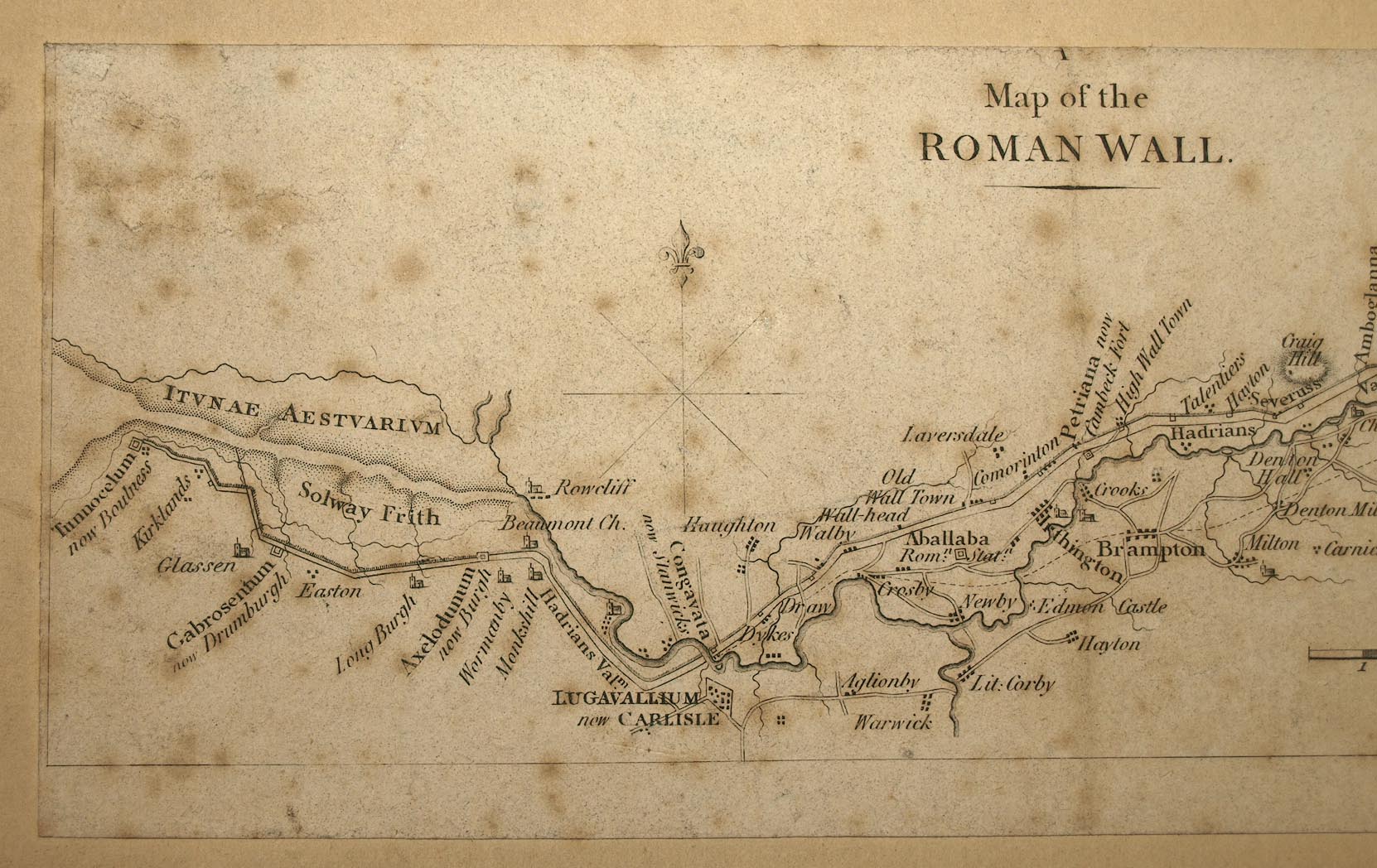
item:-
Carlisle Library : Map 330
image:-
©
Carlisle Library
M040a.jpg
Map, uncoloured engraving in four pieces, Map of the Roman Wall, Cumberland and Northumberland, scale about 4 miles to 1 inch, early 19th century??
Lakes Guides menu.
 Lakes Guides menu.