 Speed 1611

|

|
|
|
item:- Armitt Library : A6632.41 image:- © see bottom of page |
click to enlarge |
|
|
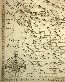
Map, uncoloured engraving, The Bishoprick of Durham,
scale about 3.5 miles to 1 inch, by John Speed 1610,
published by Thomas Bassett, The George, Fleet Street, and
Richard Chiswell, The Rose and Crown, St Paul's Churchyard,
London, 1676.
Inset map of .Durham. The reverse of the map is pp. 83 and 84; text in English. Included in The Theatre of the Empire of Great Britain by John Speed. |
||

|
Speed 1611 | |
| map feature:- | picture frame border & banner cartouche & swash lettering & vignettes (battle of Nevills Cross) & coat of arms, royal & inset map (DURHAM) & compass rose & up is N & scale line & sea moire effect & galleons & sea monsters & coast shaded & rivers & relief & hillocks & woods & parks & county & settlements | |
| inscription:- |
printed title cartouche
THE BISHOPRICK AND CITIE OF DURHAM |
|
| inscription:- |
printed with scale line
The Scale of Miles |
|
| scale line:- | 8 miles = 61.2 mm (approx) | |
| wxh, map:- | 507x382mm (about) | |
| scale:- | 1 to 210000 ? (1 to 210372 from scale line, wrongly assuming a statute mile) | |