
JandMN (182_4)
image:-
© see bottom of page

click to enlarge
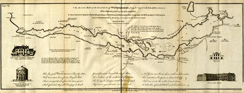
There are vignette views of Rydal old hall, Windermere Island House, Dove's nest, and Low-wood Inn. Thomas West's and Peter Crosthwaite's stations are marked.

An Accurate MAP of of the Grand Lake of WINDERMERE, being the largest in ENGLAND, situate in / WESTMORLAND and LANCASHIRE
Engrav'd by H. Ashby. / London, Published as the Act directs 16th June 1783. Republished with additions as the Act directs 1 Decr. 1788, Republished again with other additions May the 1st. 1794, and Sold by Peter Crosthwaite the Author at his Museum Keswick / Republished with further additions June 20 1809.
 Crosthwaite 1783-94