 Fisher 1845

|

|
|
|
item:- Armitt Library : ALMC2008.14.100 image:- © see bottom of page |
click to enlarge |
|
|
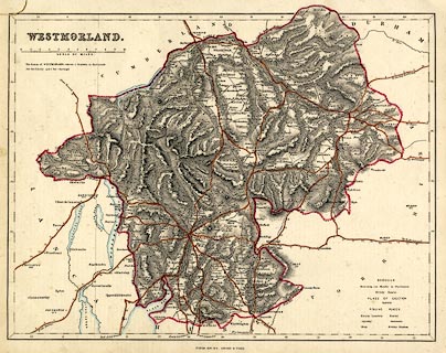
Map, hand coloured engraving, Westmorland, scale about
3.5 miles to 1 inch, published by Fisher, Son and Co, Caxton
Press, Angel Street, St Martin's le Grand, London, about
1845.
Included in Fisher's County Atlas of England and Wales. |
||

|
Fisher 1845 | |
| map feature:- | up is N & scale line & lat and long scales & lat and long grid (minimal) & sea plain & coast line & rivers & lakes & relief & hill hachuring & county & electoral data & settlements & roads & road distances & canals | |
| inscription:- |
printed upper left
WESTMORLAND |
|
| scale line:- | 10+1 miles = 83.4 mm | |
| longitude, Kendal:- | 2d 45m W | |
| scale:- | 1 to 210000 ? (1 to 212263 from scale line) | |
| wxh, sheet:- | 37x31cm | |
| wxh, map:- | 346x265mmmm | |