 Bartholomew 1900

|

|
|
|
item:- JandMN (37_5) image:- © see bottom of page |
click to enlarge |
|
|
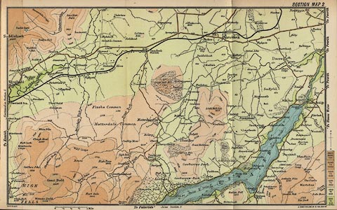
Map, Section Map 2, scale about 1 inch to 1 mile, by John
Bartholomew and Co, Edinburgh, Lothian, about 1900.
Tipped in opposite p.40 in Black's Guide to the English Lakes, published by Adam and Charles Black, London, 23rd edn 1900. The map includes the area around Great Mell Fell, north west of Ullswater. |
||

|
Bartholomew 1900 | |
| map feature:- | colour printed & north point & up is N & scale line & rivers & lakes & relief & contours & layer colouring & table of heights & settlements & roads & railways | |
| inscription:- |
printed top border
SECTION MAP 2 |
|
| inscription:- |
printed bottom left and right
COPYRIGHT / J. BARTHOLOMEW & CO., EDINR. |
|
| scale line:- | 1 mile = 25.1 mm | |
| wxh, sheet:- | 27.5x17cm | |
| wxh, map:- | 253x158mm | |
| scale:- | 1 to 64000 ? (1 to 64117 from scale line) | |