 Marshall 1808 map

|

|
|
|
item:- Kendal Library (2_1) image:- © see bottom of page |
click to enlarge |
|
|
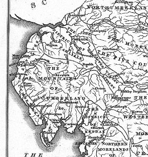
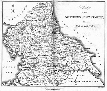
Map, Sketch of the Northern Department of England, by
William Marshall? engraved by Mutlow, Russell Court,
published by Longman, Hurst, Rees and Orme, Paternoster Row,
London, about 1808.
Included in the Review and Abstract of the County reports of the Board of Agriculture, by William Marshall, published York, North Yorkshire, 1808. The map includes Westmorland, Cumberland, Lancashire, Yorkshire, Northumberland, and Durham. |
||

|
Marshall 1808 map | |
| map feature:- | compass rose & up is N & sea plain & coast form lines & rivers & land utilisation & settlements | |
| inscription:- |
printed upper right
Sketch / of the / NORTHERN DEPARTMENT, / of / ENGLAND. |
|
| inscription:- |
printed bottom centre and right
Publish'd by Longman, Hurst, Rees & Orme, Paternoster Row. To be hung in with a Guard, before Page 1 / Mutlow sc Russell Ct. |
|
| wxh, map:- | 230x190mm | |
|
||
|
|
notes | |