 Cruchley c1870

|

|
|
|
item:- private collection (38) image:- © see bottom of page |
click to enlarge |
|
|
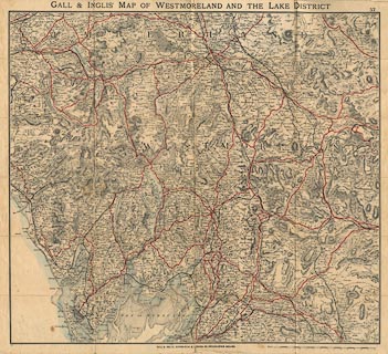
Map, coloured lithograph? Westmorland and the Lake
District, scale about 2.5 miles to 1 inch, by George F
Cruchley, perhaps about 1870, edition published by Gall and
Inglis, Edinburgh, Lothian and 25 Paternoster Square,
London, about 1900s.
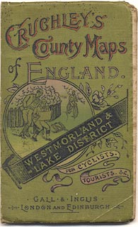
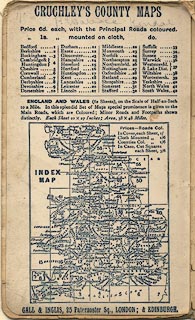
The cover illustration includes bicycles of the 1900s-10s; the map has number 37; Cruchley's County maps is advertised inside the cover, sheet 37 is not here, and there is no map corresponding to this one in the index diagram. The dates are guesses. |
||

|
Cruchley c1870 | |
| map feature:- | mounted & folded & card cover & up is N & scale line & sea plain & coast tinted & rivers & lakes & relief & hill hachuring & woods & forests & parks & county & wards (hundreds) & settlements & roads & railways & canals | |
| inscription:- |
printed cover
CRUCHLEY'S / COUNTY MAPS / of ENGLAND. / WESTMORLAND & / LAKE DISTRICT / FOR CYCLISTS, / TOURISTS, &C. / GALL & INGLIS / LONON & EDINBURGH black, red and white on green; illustration of walkers using a map, and a cyclist |
|
| inscription:- |
printed top centre and right
GALL & INGLIS' MAP OF WESTMORLAND AND THE LAKE DISTRICT / 37 |
|
| inscription:- |
printed bottom
GALL & INGLIS, EDINBURGH & LONDON, 25, PATERNOSTER SQUARE. |
|
| scale line:- | 15 miles = 147.0 mm | |
| scale:- | 1 to 160000 ? (1 to 164219 from scale line) | |
| wxh, cover:- | 9x15cm | |
| wxh, folded:- | 9x14.5cm | |
| wxh, sheet:- | 58x50.5cm | |
| wxh, map:- | 534x479mm | |
|
||
|
||