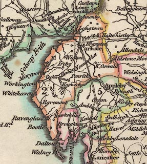
 Laurie and Whittle 1806

|

|
|
|
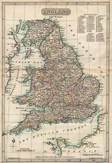
item:- private collection (18_0) image:- © see bottom of page |
click to enlarge |
|
|
Road map, England and Wales, scale about 42 miles to 1
inch, by Nathaniel Coltman? published by Robert H Laurie, 53
Fleet Street, London, 1829.
Published in Laurie's New Traveller's Companion, 1834. |
||

|
Laurie and Whittle 1806 | |
| map feature:- | plain cartouche & north point & scale line & lat and long scales & sea plain & coast shaded & rivers & county & settlements & roads | |
| inscription:- |
printed title cartouche and below
ENGLAND / AND WALES. |
|
| inscription:- |
printed lower centre
[Published, July 20th. 1829, by Richard Holmes Laurie - No.53 Fleet Street, London.] |
|
| scale line:- | 70 miles = 42.0 mm | |
| scale:- | 1 to 2700000 ? (1 to 2682240 from scale line assuming a statute mile) | |
| wxh, sheet:- | 26.5x37cm | |
| wxh, map:- | 239x353mm | |
|
||