 Black 1870s

|

|
|
|
item:- JandMN (26) image:- © see bottom of page |
click to enlarge |
|
|
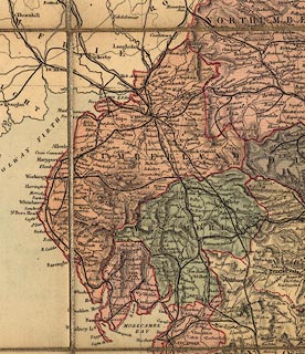
Railway map, colour printed, Black's Road and Railway
Travelling Map of England, scale about 14 miles to 1 inch,
engraved by S Hall, published by A and C Black, Edinburgh,
Lothian, early 1870s.
|
||

|
Black 1870s | |
| map feature:- | colour printed & sectioned for folding & mounted & folded & card cover & plain cartouche & up is N & scale line & lat and long scales & lat and long grid & table of symbols & sea tinted & coast line & rivers & relief & hill hachuring & county & settlements & roads & railways & canals | |
| inscription:- |
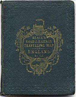
embossed cover
BLACK'S / ROAD & RAILWAY / TRAVELLING MAP / OF / ENGLAND / 4s. 6d. gold on dark green; illustrated with a 2-2-2 railway locomotive and a stage coach |
|
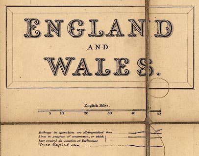
| inscription:- |
printed upper right in a plain cartouche
ENGLAND / AND / WALES |
|
| inscription:- |
printed bottom
Edinburgh, Published by A. & C. Black. / Engraved by S Hall, Bury Str. Bloomsbury |
|
| scale line:- | 50 miles = 88.8 mm | |
| wxh,folded in cover:- | 12x15cm | |
| wxh, sheet:- | 66.5x87cm | |
| wxh, map:- | 570x820mm | |
| scale:- | 1 to 900000 ? (1 to 906162 from scale line) | |
|
||
|
||
|
|
notes | |