item:- Armitt Library : 2008.14.23
image:- © see bottom of page
 LS18.jpg
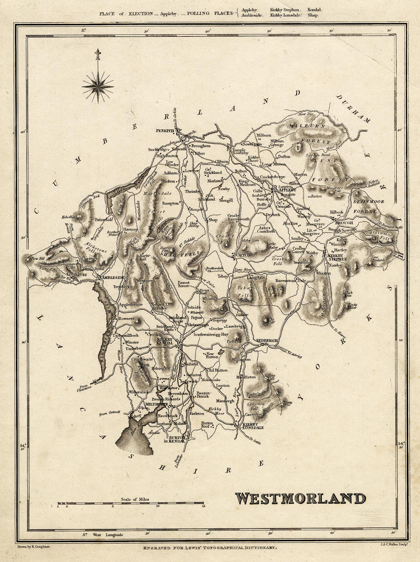
Map, uncoloured engraving, Westmorland, scale about 6.5 miles to
1 inch, drawn by R Creighton, engraved by John and Charles
Walker, published by Samuel Lewis and Co, 87 Aldersgate Street,
London, from 1831, edn 1833.
 Lakes Guides menu.