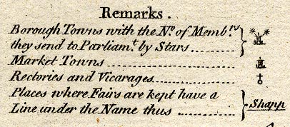
Maps, Westmoreland, scale about 5.5 miles to 1 inch, and Cumberland, scale about 8 miles to 1 inch, by Thomas Kitchin, published by R and J Dodsley, Pall Mall, London, 1763-64. (Kitchin 1763)
Lakes Guides menu.
 Lakes Guides menu.