item:- Armitt Library : 2008.14.13
image:- © see bottom of page
 HS01.jpg
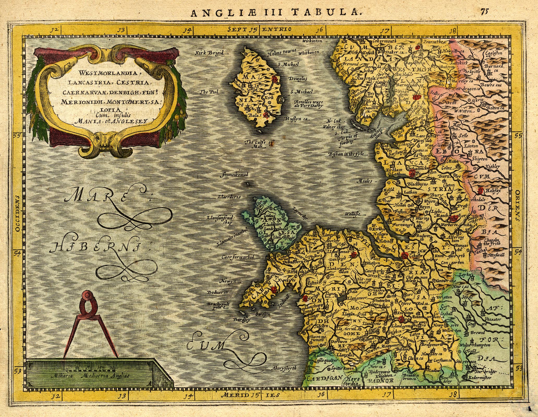
Map, hand coloured engraving, Westmorlandia, Lancastria, Cestria
... ie Westmorland, Lancashire, Cheshire ..., which is England
plate 3, scale about 21.5 miles to 1 inch, probably engraved by
Peter Keer, published by John Cloppenburg, Amsterdam,
Netherlands, 1630, edition 1632.
 Lakes Guides menu.