 Cooper 1808

|

|
|

|
back to object record | |
| MAP FEATURES | ||
|
|
||
|
title cartouche
plain cartouche publisher |
Printed upper right in a plain title cartouche:-
WESTMORELAND under which:- in which is laid down every Parish & Place containing upwards of 20 Houses. Printed bottom centre:- Published by G. & W. B. Whittaker, 13, Ave Maria Lane, 1824. |
|
|
|
||
| descriptive text |
Basic descriptive data about the county is tabulated
lower right:-
Boroughs. ... 1 Market Towns. ... 7 Parishes. ... 32 Inhabited houses. ... 9,243 Inhabitants. ... 51,359 Acres of Land. ... 488,320 Arable. ... 40,000 Pasturage. ... 140,000 Members of Parliament. 4. |
|
|
|
||
|
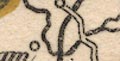
orientation
north point up is N |
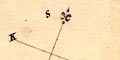
Printed lower right of centre is a north point; N-S line, E-W line, North marked by a ?fleur de lys. The map is printed with NNW, roughly North, at the top of the sheet, though it would probably have been bound in its book sideways. |
|
|
|
||
|
scale line
scale |
Printed lower right is a scale of:-
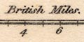
British Miles divided in miles, labelled at 2 mile intervals. The 10 miles = 29.0 mm gives a scale 1 to 554946 assuming a statute mile. The map scale is about:- 1 to 550000 9 miles to 1 inch |
|
|
|
||
|
sea area
sea shaded |
The sea area, Morecambe Bay, is shaded and tinted
blue.
|
|
|
|
||
| coast line |
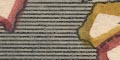
The coast line is not emphasised, except its incidental colouring as the county boundary. |
|
|
|
||
|
rivers
bridges |
Rivers are drawn by wiggly line tapering upstream. Some rivers are labelled, eg:- Lune or Loyne R. Ken R. Winster R. 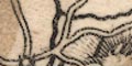
Bridges are implied where a road crosses and interrupts a stream. None seem to be named. |
|
|
|
||
| lakes |
Lakes are drawn in outline, shaded, and might be tinted blue. Some lakes are labelled:- Winander Mere Ulles Water Hawes Water Skeggles Water Others can be recognised:- Kentmere tarn Brothers Water Rydal Water Grasmere Easedale Tarn (?) ?Sunbiggin Tarn |
|
|
|
||
|
relief
hill hachuring |
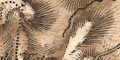
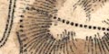
Relief is indicated by hill hachuring, tinted brown. Some hills are labelled, eg:- Orton Scar High Street Langdale Fells A valley might be labelled, eg:- Swindale |
|
|
|
||
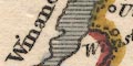
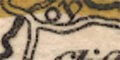
| county |
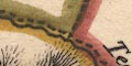
County boundaries are a dashed line, each county tinted on its inner side: Westmorland yellow, Cumberland green, Lancashire red, Yorkshire blue, Durham red. Adjacent counties are labelled, eg:- CUMBERLAND YORKSHIRE Very little is shown outwith the county. |
|
|
|
||
|
wards
table of wards |
Wards, comparable to hundreds. Their boundaries are a dotted line. The ward areas are labelled by number keying to a table printed lower right:- Wards 1. West. 2. East. 3. Kendal. 4. Lonsdale. |
|
|
|
||
|
settlements
electoral data |
Settlements are positioned by a circle, with few added
elements, and are mostly undifferentiated by style of
labelling.
|
|
| towns |
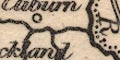
circle with upright bars each side; labelled in italic
lowercase text, eg:-
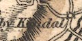
Kirkby Kendal Orton A double circle, tinted red, with two spots attached on stalks, labelled in upright lowercase text is:- 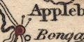
Appleby This is the de jure county town, sending two members to Parliament. The more usual convention for members is asterisks, not spots. |
|
|
villages
hamlets |
circle; labelled in italic lowercase text, eg:-
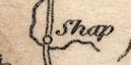
Shap Beetham Selside and Whitwell Some of these mark parishes rather than nuclear settlements. |
|
|
|
||
| roads |
A network of roads is drawn by double line |
|
|
|
||
| canals |
A canal is drawn by a curvy bold line. This is the:- Lancaster to Kendal Canal |
|
Lakes Guides menu.