item:- Carlisle Library : Map 251
image:- © Carlisle Library
 CLN8.jpg
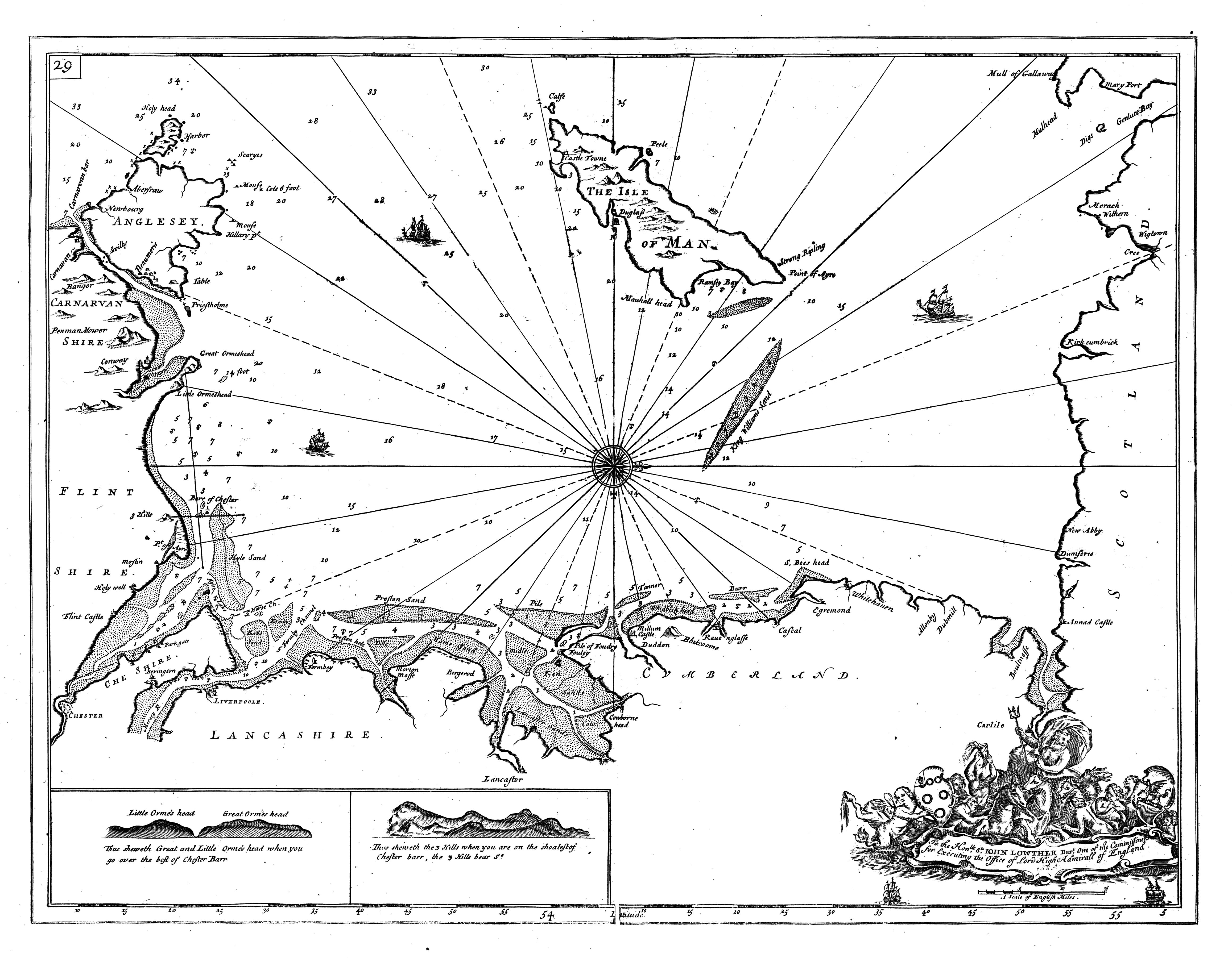
Chart, uncoloured engraving, the Irish Sea, scale about 6.5 nautical miles to 1 inch,
by Captain Greenville Collins, 1693, published by W and J Mount and T Page, London,
1785.
 Lakes Guides menu.