 Butters 1803

|

|
|

|
back to object record | |
| Map Features | ||
|
|
||
| title |
Printed at the bottom:-
WESTMORELAND. |
|
|
|
||
|
orientation
north point up is W |
Printed upper right is a north point, pointing South! N-S line, South marked the north symbol, a spear head. The map is printed with West at the top of the sheet. |
|
|
|
||
|
scale line
scale |
Printed above a scale line, lower left, is:-
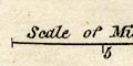
Scale of Miles marked and labelled at 5 and 10. The 10 miles = 22.0 mm gives a scale 1 to 731520 assuming a statute mile. The map scale is about:- 1 to 730000 11.5 miles to 1 inch |
|
|
|
||
|
sea area
sea shaded sea tinted |
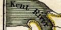
The tiny amount of sea area shown in the Kent Estuary is
shaded and tinted blue green.
|
|
|
|
||
|
coast line
coast shaded |
The tiny amount of coast line shown in the Kent Estuary is shaded for emphasis. The map border at the edge of the sea area is also shaded like a coast line. |
|
|
|
||
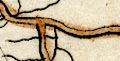
| rivers |
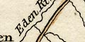
Rivers are drawn by thin wiggle lines, most are not labelled but notice:- Eden River and, in its estuary:- Kent River The rivers shown can best be described as a muddle. For example various rivers flow to Kendal from the NE, N and NW, then stop; the Lune ends at Tebay; and so on. Apart from being wrong, rivers seem to stop when they meet a feature like a boundary or road going the same way. |
|
|
|
||
| lakes |
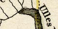
Lakes are drawn in outline, shaded, and tinted blue green. Some lakes are labelled:- Horns Water [Hawes Water] Ulles Water Windander Mere Other lakes might be recognized, eg:- Grasmere (perhaps) Skeggles Water (perhaps) The ferry across Windermere is shown by the road crossing the lake. |
|
|
|
||
| parks |
Two parks are shown by an outline of fence palings, the
interior pecked, tinted green. They are labelled:-
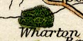
Wharton Park Trogtbeck Park |
|
|
|
||
| county |
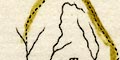
The county boundary is a dotted line, tinted yellow, not continued where a feature is the boundary, though marking the boundary seems to take precedence over marking a river that is a boundary feature, for example at the north of Ullswater. 
The boundary runs through Ullswater as it does now, but is drawn to exclude Windermere lake from the county. Adjacent counties are labelled, eg:- CUMBERLAND LANCASHIRE |
|
|
|
||
| settlements |
Settlements are labelled in different styles, but not
marked.
|
|
| towns |
labelled in upright lowercase text, eg:-
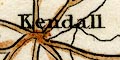
Kendall Ambleside List of towns etc, see |
|
|
villages
hamlets |
labelled in italic lowercase text, eg:-
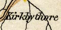
Kirkbythore Staveley Thrimby |
|
|
|
||
| roads |
Roads are drawn by a double line, light bold, tinted brown. A limited number of roads is shown on this small map, perhaps just turnpikes. |
|
Lakes Guides menu.