item:-
JandMN : 84.1
image:-
©
see bottom of page
BLR1.jpg
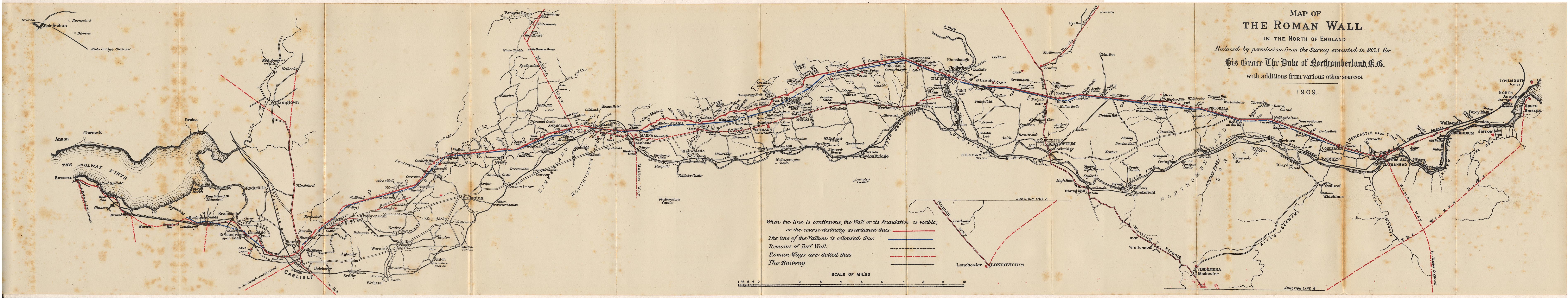
Map of the Roman Wall, in Cumberland, and Northumberland, scale about 2 miles to 1 inch, derived from a survey for the Duke of Northumberland, 1853, by Robert Blair, 1909?
Lakes Guides menu.
 Lakes Guides menu.