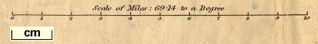
Map, The Lake District of Cumberland, Westmorland and
Lancashire, ie Cumbria, scale about 3.5 miles to 1 inch,
inserted in Black's Picturesque Guide to the Lakes,
published by Adam and Charles Black, North Bridge,
Edinburgh, Lothian, 1841. And 4 small maps of parts of the
Lake District:- Derwent Water and Bassenthwaite; Buttermere,
Crummock and Lowes Water; Winandermere, Coniston and
Grasmere; and Ulles Water; each about 1.5 to 2.5 miles to 1
inch. (Black 1841 map)
 Lakes Guides menu.