 |
 |
|
|
|
|
Moorthwaite |
| civil parish:- |
Woodside (formerly Cumberland) |
| civil parish:- |
Westward (formerly Cumberland) |
| county:- |
Cumbria |
| locality type:- |
locality |
| locality type:- |
buildings |
| coordinates:- |
NY29354876 |
| 1Km square:- |
NY2948 |
| 10Km square:- |
NY24 |
|
|
| evidence:- |
old map:- OS County Series (Cmd 29 7)
placename:- Moorthwaite
|
| source data:- |
Maps, County Series maps of Great Britain, scales 6 and 25
inches to 1 mile, published by the Ordnance Survey, Southampton,
Hampshire, from about 1863 to 1948.
|
|
|
| evidence:- |
old map:- Donald 1774 (Cmd)
placename:- Moorthwaite
|
| source data:- |
Map, hand coloured engraving, 3x2 sheets, The County of Cumberland, scale about 1
inch to 1 mile, by Thomas Donald, engraved and published by Joseph Hodskinson, 29
Arundel Street, Strand, London, 1774.
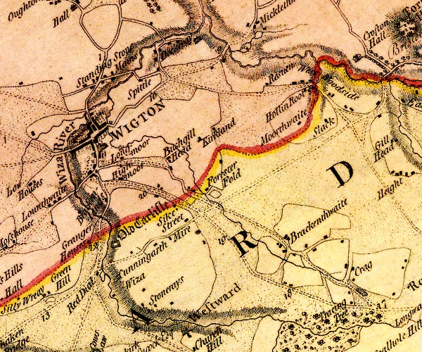
D4NY24NE.jpg
"Moorthwaite"
block or blocks, labelled in lowercase; a hamlet or just a house
item:- Carlisle Library : Map 2
Image © Carlisle Library |
|
|
| places:- |
 |
NY29394884 Moorthwaite Cottage (Woodside) L |
|
|
|
NY29184846 Moorthwaite Lough (Woodside / Westward) |
|
|
|
NY29324874 Moorthwaite (Woodside) L |
|
|
|
NY50344950 quarry, Cumwhitton (Cumwhitton) |
|
|
|
NY29464845 Wath Head (Westward) |
|
|
|
NY50895071 Whinnyhill (Cumwhitton) |
|
|
|
NY503503 Moorthwaite Quarries (Cumwhitton) |
|
