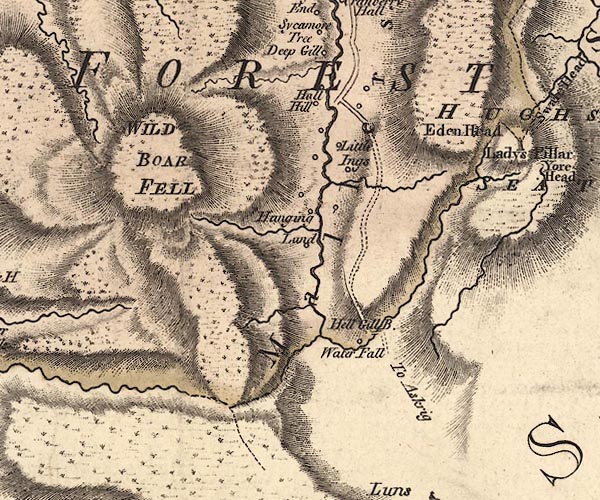
 Jefferys 1770 SD79NE

|

|
|
|
gazetteer links places may or may not be labelled on the map |
||

|
-- Ais Gill |
|
|
|
-- Deep Gill |
|
|
|
-- Deep Gill -- "Deep Gill" |
|
|
|
-- Eden Springs -- "Eden Head" |
|
|
|
-- Eden, River -- "Eden River" -- "Eden
River" -- "Eden R." |
|
|
|
-- Far Cote Gill |
|
|
|
-- Hall Hill -- "Hall Hill" |
|
|
|
-- Hanging Lund -- "Hanging Lund" |
|
|
|
-- Hell Gill Beck |
|
|
|
-- Hell Gill Bridge -- "Hell Gill B." |
|
|
|
-- Hellgill Force -- "Water Fall" |
|
|
|
-- Little Ing Farm -- "Little Ings" |
|
|
|
-- Mallerstang Forest -- "MALLERSTANG FOREST" |
|
|
|
-- Mallerstang -- "Mallerstang" |
|
|
|
-- Near Cote Gill |
|
|
|
-- Kirkby Stephen to Moorcock -- "to Askrigg" |
|
|
|
-- Smithy Gill |
|
|
|
-- Highway, The (part) -- "To Askrig" |
|
|
|
-- Wild Boar Fell -- "WILD BOAR FELL" |
|
|
civil parishes The area roughly includes parts of parishes:- Ravenstonedale Mallerstang Sedbergh Garsdale |
||
|
counties The area includes parts of counties:- North Yorkshire |
||
|
|
||
|
|
Lakes Guides menu. | |