 Jefferys 1770 NY60SE

|

|
|
|
gazetteer links places may or may not be labelled on the map |
||

|
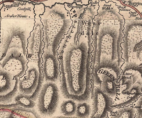
-- Archer Hill -- "Arsher House" |
|
|
|
-- Bowderdale Head |
|
|
|
-- Bowderdale valley -- "Bouthersdale" |
|
|
|
-- Green Bell -- "GREEN BELL" |
|
|
|
-- Hooksey |
|
|
|
-- Howgill Fells-- Howgill Fells -- "HOUGILL FELLS" |
|
|
|
-- Langdale Fell -- "LANGDALE FELLS" |
|
|
|
-- Weasdale |
|
|
|
-- Weasdale -- "Weas Dale" |
|
|
|
-- West Fell |
|
|
civil parishes The area roughly includes parts of parishes:- Orton S Ravenstonedale |
||
|
|
||
|
|
Lakes Guides menu. | |