 Jefferys 1770 NY31SW

|

|
|
|
gazetteer links places may or may not be labelled on the map |
||

|
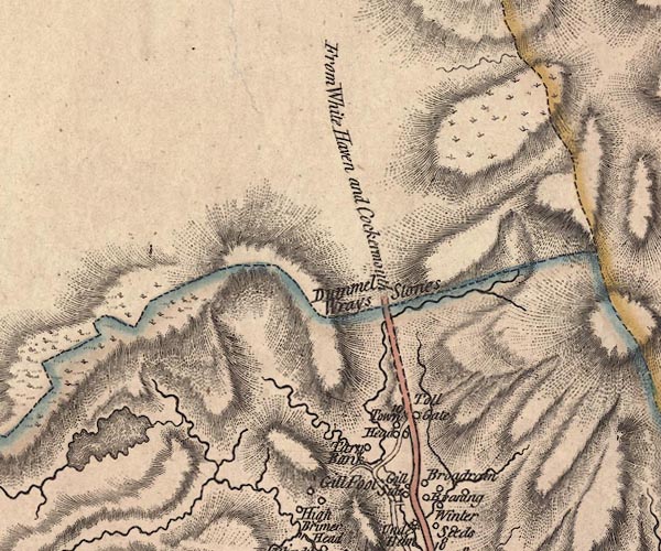
-- Dunmail Raise Stones -- "Dummel Wrays Stones" |
|
|
|
-- Easedale Tarn |
|
|
|
-- Far Easedale Gill |
|
|
|
-- Ghyll Foot -- "Gill Foot" |
|
|
|
-- Gill Side -- "Gill Side" |
|
|
|
-- Green Burn |
|
|
|
-- High Broadrain -- "Broadrain" |
|
|
|
-- Little Brinhowe Gill |
|
|
|
-- Raise Beck |
|
|
|
-- Ambleside to Keswick -- "From White Haven and
Cockermouth" |
|
|
|
-- Sour Milk Gill |
|
|
|
-- Steel Fell |
|
|
|
-- Tarn Howe -- "Tarn Bank" |
|
|
|
-- Toll Bar Cottage -- "Toll Gate" |
|
|
|
-- Town Head Farm -- "Town Head" |
|
|
civil parishes The area roughly includes parts of parishes:- St John's Castlerigg and Wythburn Patterdale Lakes |
||
|
|
||
|
|
Lakes Guides menu. | |