 Jansson 1646 NY22


|

|
|
|
gazetteer links places may or may not be labelled on the map |
||

|
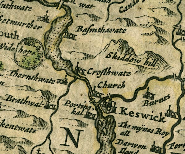
-- Bassenthwaite Lake |
|
|
|
-- Bassenthwaite -- "Bassenthwaite" |
|
|
|
-- Braithwaite -- "Brathwat" |
|
|
|
-- Burns Farm -- "Burnes" |
|
|
|
-- Derwent Isle -- "The mÿnes Royall / Darwen
Iland" |
|
|
|
-- Derwent Water |
|
|
|
-- Derwent, River -- "Darwen fl." |
|
|
|
-- Great Crosthwaite -- "Crosthwate Church" |
|
|
|
-- Greta Bridge |
|
|
|
-- Greta, River |
|
|
|
-- Keswick -- "Keswick" |
|
|
|
-- Little Crosthwaite -- "Crosthwate" |
|
|
|
-- Long Bridge |
|
|
|
-- Newlands Beck |
|
|
|
-- Portinscale -- "Portinskal" |
|
|
|
-- Setmurthy -- "Setmurther" |
|
|
|
-- Skiddaw -- "Skiddow hill" |
|
|
|
-- Thornthwaite -- "Thornthwate" |
|
|
|
-- Wythop Hall -- "Widehope" |
|
|
civil parishes The area roughly includes parts of parishes:- Above Derwent St John's Castlerigg and Wythburn Underskiddaw Borrowdale Mungrisdale Keswick Lorton Wythop Bassenthwaite Threlkeld |
||
|
|
||
|
|
Lakes Guides menu. | |